Until the early 1900s, central California’s Tulare Lake naturally
appeared every winter as the southernmost rivers flowing out of
the Sierra Nevada Mountains filled the dry lakebed with rainfall
and melted snow.
Farmers adjacent to the lake also used the water to irrigate
their lands. But the variable shoreline made growing seasons
unpredictable. In response, Pine Flat Dam was built by the U.S.
Army Corps of Engineers to control Kings River flows. The Kings
River is still used extensively for irrigation.
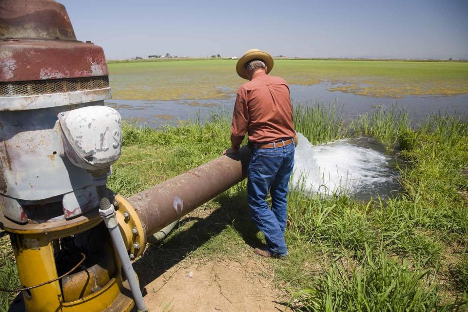
Because the Tulare Lake Basin’s irrigation water does not have an
outlet, agricultural drainage is stored in a series of
evaporation ponds in and near the lakebed, which has been
converted to farm fields. By the 1980s the water drained
into 28 ponds totaling 7,300 acres. Crop production improved in
part due to improved drainage. Today, drainage water from about
44,046 acres of farmland is contained and evaporated from eight
basins encompassing 4,740 acres of evaporation ponds.
More than a year after floods devastated the small town of
Woodlake in Tulare County, residents finally feel hopeful about
the future thanks to new infrastructure projects and an ongoing
lawsuit they are bringing against local governments and other
agencies. In March of 2023, homes in northwest Woodlake
were hit with floods after historic storms and snowpack brought
a deluge onto the valley floor. It took many residents months
and tens of thousands of dollars to repair their homes.
Residents banded together and took legal action against what
they said was a government failure to properly prepare and
respond to the floods.
From Sequoia Park to the old Tulare Lake bed, local authorities
recount the same story. A deluge of biblical proportions,
including heavy rain and storm runoff, in the past year in the
Kaweah, Kings and Tule basins has caused hundreds of millions
of dollars in damage to the region’s road and bridge
infrastructure. … Still a year later, government
agencies continue to struggle to repair the extensive damage
requiring federal funding to make it happen.
In much of the United States, groundwater extraction is
unregulated and unlimited. There are few rules governing who
can pump water from underground aquifers or how much they can
take. This lack of regulation has allowed farmers nationwide to
empty aquifers of trillions of gallons of water for irrigation
and livestock. Droughts fueled by climate change have
exacerbated this trend by depleting rivers and reservoirs,
increasing reliance on this dwindling groundwater. In many
places, such as California’s Central Valley, the results
have been devastating. As aquifers decline, residential wells
start to yield contaminated water or else dry up
altogether, forcing families to rely on emergency deliveries of
bottled water.
Kings County growers will face millions of dollars in fees and
a mandate to report groundwater pumping after California
officials voted unanimously today to put local agencies on
probation for failing to protect the region’s underground water
supply. The unprecedented decision is a first step that could
eventually lead to the state wresting control of a groundwater
basin in a severely depleted part of the San Joaquin
Valley. Before issuing the probation order, the State
Water Resources Control Board had repeatedly warned five
groundwater agencies in Kings County that their management plan
for the Tulare Lake basin is seriously deficient, failing to
rein in the dried-up wells, contaminated water and sinking
earth worsened by overpumping.
For the first time in California history, state officials are
poised to crack down on overpumping of groundwater in the
agricultural heartland. The State Water Resources Control
Board on Tuesday will weigh whether to put Kings County
groundwater agencies on probation for failing to rein in
growers’ overdrafting of the underground water supply.
Probation — which would levy state fees that could total
millions of dollars — is the first step that could allow
California regulators to eventually take over management of the
region’s groundwater.
For a time last year, it was difficult to drive through a large
swath of central California without running into the new
shoreline of a long dormant lake. Resurrected for the
first time in decades by an epic deluge of winter rain and
snow, by spring the lake covered more than 100,000 acres,
stretching over cotton, tomato and pistachio fields and miles
of roads. Tulare Lake, or Pa’ashi as it is known to the Tachi
Yokut Tribe, was back. … Scientists and officials predicted
the lake could remain for years to come, sparking consternation
among the local farmers whose land was now underwater, and
excitement from others who saw the lake as a fertile nature
sanctuary and sacred site. … Despite the predictions, the
lake is nearly gone.
Residents living below the Isabella Auxiliary Dam were thrilled
earlier this month with a temporary fix that finally dried up
excessive seepage from the dam that had been swamping septic
systems and breeding forests of mosquito-infested weeds around
their homes. The didn’t realize how temporary the fix would be,
however. After only 12 days without a river cutting through his
land, rancher Gerald Wenstrand woke up to see the seepage back
on Saturday.
… A state audit from the California Water Resources Control
Board released last year found that over 920,000 residents
faced an increased risk of illness–including cancer, liver and
kidney problems–due to consuming unsafe drinking water. A
majority of these unsafe water systems are in the Central
Valley. The matter has prompted community leaders to mobilize
residents around water quality as politicians confront
imperfect solutions for the region’s supply. Advocates point
out that impacted areas, including those in Tulare County, tend
to be majority Latino with low median incomes. … This
year’s extreme weather has only worsened the valley’s problems.
The storms that hit California at the start of this year caused
stormwater tainted with farm industry fertilizer, manure and
nitrates to flow into valley aquifers.
A new underground mapping technology
that reveals the best spots for storing surplus water in
California’s Central Valley is providing a big boost to the
state’s most groundwater-dependent communities.
The maps provided by the California Department of Water Resources
for the first time pinpoint paleo valleys and similar prime
underground storage zones traditionally found with some guesswork
by drilling exploratory wells and other more time-consuming
manual methods. The new maps are drawn from data on the
composition of underlying rock and soil gathered by low-flying
helicopters towing giant magnets.
The unique peeks below ground are saving water agencies’
resources and allowing them to accurately devise ways to capture
water from extreme storms and soak or inject the surplus
underground for use during the next drought.
“Understanding where you’re putting and taking water from really
helps, versus trying to make multimillion-dollar decisions based
on a thumb and which way the wind is blowing,” said Aaron Fukuda,
general manager of the Tulare Irrigation District, an early
adopter of the airborne electromagnetic or
AEM technology in California.
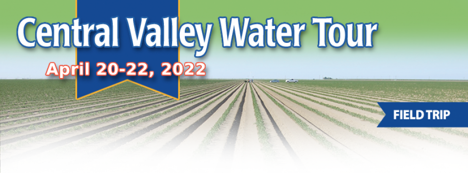
This tour ventured through California’s Central Valley, known as the nation’s breadbasket thanks to an imported supply of surface water and local groundwater. Covering about 20,000 square miles through the heart of the state, the valley provides 25 percent of the nation’s food, including 40 percent of all fruits, nuts and vegetables consumed throughout the country.
There’s going to be a new governor
in California next year – and a host of challenges both old and
new involving the state’s most vital natural resource, water.
So what should be the next governor’s water priorities?
That was one of the questions put to more than 150 participants
during a wrap-up session at the end of the Water Education
Foundation’s Sept. 20 Water Summit in Sacramento.
A new era of groundwater management
began in 2014 with the passage of the Sustainable Groundwater
Management Act (SGMA), which aims for local and regional agencies
to develop and implement sustainable groundwater management
plans with the state as the backstop.
SGMA defines “sustainable groundwater management” as the
“management and use of groundwater in a manner that can be
maintained during the planning and implementation horizon without
causing undesirable results.”
This 25-minute documentary-style DVD, developed in partnership
with the California Department of Water Resources, provides an
excellent overview of climate change and how it is already
affecting California. The DVD also explains what scientists
anticipate in the future related to sea level rise and
precipitation/runoff changes and explores the efforts that are
underway to plan and adapt to climate.
Salt. In a small amount, it’s a gift from nature. But any doctor
will tell you, if you take in too much salt, you’ll start to have
health problems. The same negative effect is happening to land in
the Central Valley. The problem scientists call “salinity” poses
a growing threat to our food supply, our drinking water quality
and our way of life. The problem of salt buildup and potential –
but costly – solutions are highlighted in this 2008 public
television documentary narrated by comedian Paul Rodriguez.
A new look for our most popular product! And it’s the perfect
gift for the water wonk in your life.
Our 24×36 inch California Water Map is widely known for being the
definitive poster that shows the integral role water plays in the
state. On this updated version, it is easier to see California’s
natural waterways and man-made reservoirs and aqueducts
– including federally, state and locally funded
projects – the wild and scenic rivers system, and
natural lakes. The map features beautiful photos of
California’s natural environment, rivers, water projects,
wildlife, and urban and agricultural uses and the
text focuses on key issues: water supply, water use, water
projects, the Delta, wild and scenic rivers and the Colorado
River.
Until the early 1900s, Central
California’s Tulare Lake appeared every winter as the
southernmost rivers flowing out of the Sierra Nevada filled the
dry lakebed with rainfall and melted snow.
In the spring, the shallow lake near Visalia could cover as much
as 790 square miles or four times the surface area of Lake Tahoe.
However, by the end of the hot San Joaquin Valley summer, the
giant lake – once the largest freshwater body west of the
Mississippi River – could disappear primarily due to evaporation.


")
")