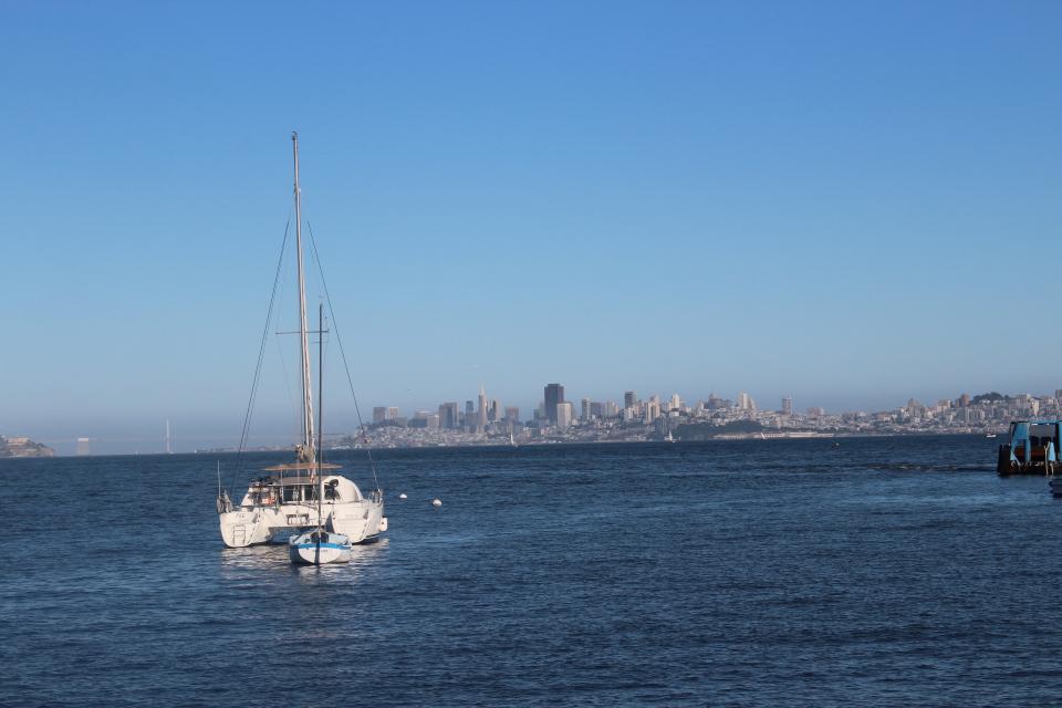
The San Francisco Bay (Bay) drains water from 40 percent of
California. This includes flows originating from the Sierra
Nevada mountain range and the Sacramento and San Joaquin rivers
that make their way down through Sacramento-San Joaquin Bay Delta
through the Bay to the Pacific Ocean.
The Bay is the largest harbor on the U.S. Pacific Coast and
covers about 400 square miles with an average depth of 14 feet.
Its deepest point is 360 feet at the Golden Gate.
Every year, more than 67 million tons of cargo pass through the
Golden Gate. The Bay also supports commercial bait shrimp,
herring and Dungeness crab fisheries.
The Bay is a vital estuary and a key link in the Pacific Flyway,
and millions of waterfowl use the shallow portions of the bay as
a refuge each year.
In recently published research, a consortium of local, state,
and federal agencies including USGS and NOAA introduces the
Advanced Quantitative Precipitation Information (AQPI) system,
which aims to improve prediction and monitoring of
precipitation, streamflow, and coastal flooding in the San
Francisco Bay Area. Combining real-time observations with
state-of-the-art modeling, AQPI represents a significant
advancement in forecasting capability. Developed as a response
to the urgent need for better water-management tools in
California, this experimental system will bolster
decision-making processes for communities vulnerable to extreme
weather events. The Bay Area’s complex landscape, nestled
between coastal mountain ranges, has long posed challenges for
accurate precipitation monitoring.
Long before rising seas wash over San Francisco’s shores and
flood its streets, rising groundwater mixed with salt water
from the bay could touch and degrade underground structures
like sewage lines and building foundations. … That’s the
implication of a study released this week by
scientists at the University of Hawaii at Manoa. They compiled
research from around the globe showing that as sea levels rise,
coastal groundwater is lifted closer to the surface while also
becoming saltier, more corrosive and potentially more
destructive to subterranean systems. … Habel’s
publication aligns with a growing body of data from Bay Area
researchers and others about the risks posed by rising
groundwater as sea levels are projected to rise …
The San Francisco Bay could experience a foot of water in sea
level rise by 2050 if high emissions continue, according to the
State of California’s Sea-Level Rise Guidance Report. There is
a push for major spending to control flooding in the Bay Area
before that scenario plays out – and one of the proposed
solutions is tidal marsh. Like many Pacific Islanders living
around East Palo Alto, the shoreline is a spiritual place to
Anthony Tongia and Violet Saena. … According to the
USDA Forest Service, more than 80 percent of the San Francisco
Bay’s original tidal wetlands have been altered or displaced.
This has impacted habitats and species that live along the
shoreline. It also partially led to recurring flooding in
several areas along the Bay.
Palo Alto’s bioreactor towers are aging out, like a lot of the
clean water infrastructure constructed around the Bay Area in
the 1950s-1970s. Recent wind gusts, swirling around the edges
of February’s atmospheric river storms, have not been friendly
to the towers either. On a March visit to the Palo Alto
Regional Water Quality Control Plant, which treats 18 million
gallons of wastewater every day, I could see a big chunk
missing from the wall of one rusty cauldron and tumbleweeds
caught in the metalwork. Elsewhere on the 25-acre site,
the plant’s facilities are visibly undergoing a $193 million
overhaul. The overhaul will help the plant meet increasing
regulatory limits on the amount of nitrogen that dischargers
can pipe into the shallows of San Francisco Bay.
The water in California’s San Francisco Bay could rise more
than two meters by the year 2100. For the region’s tidal
marshes and their inhabitants, such as the endangered Ridgway’s
rail and the salt marsh harvest mouse, it’s a potential death
sentence. Given enough time, space, and sediment, tidal marshes
can build layers of mud and decaying vegetation to keep up with
rising seas. Unfortunately, upstream dams and a long history of
dredging bays and dumping the sediment offshore are starving
many tidal marshes around the world of the sediment they need
to grow. To keep its marshes above water, San Francisco Bay
needs more than 545 million tonnes of dirt by 2100.
The California Department of Fish and Wildlife recommended
Alternative 3 – Salmon Closure during the final days of the
Pacific Fisheries Management Council (PFMC) meeting mirroring
the opinions of commercial and recreational charter boat
anglers. The department’s position is a significant change from
early March. The PFMC meetings are being held in Seattle from
April 6 to 11, and the final recommendations of the council
will be forwarded to the California Fish and Game Commission in
May.
Marin County and Novato are disputing a state water board’s
contention that they are doing too little to prevent the
discharge of fecal bacteria into the Petaluma River. The San
Francisco Bay Regional Water Quality Board notified both the
county and Novato in January that they are out of compliance
with a program that it adopted in 2019 to reduce the level of
fecal bacteria in the river. Both jurisdictions, however,
contend that they are not required to comply with the program
because the scheme has not yet been incorporated into their
municipal storm sewer system permits, which are issued by the
State Water Resources Control Board.
At least $11 billion would be needed to upgrade wastewater
treatment facilities across the Bay Area if regulators impose
anticipated stricter environmental rules, according to a
regional water board that seeks to protect the San Francisco
Bay. The upgrades at dozens of sewage treatment plants,
needed to prevent toxic algae blooms and protect fish, would
cost an average of $4,000 per household, and consumers may end
up funding the improvements. The key culprit? Nitrogen
found in urine and fecal matter, which feeds the growth of
algae.
Nature is not what comes to mind when an outsider drives
into Bel Marin Keys, a tiny community that begins 1½ miles
east of Highway 101 in Marin County, reached by a single road
that passes a shopping center and small industrial buildings
along the way. The wide streets are monotonous, often lined
with homes that resemble those of countless 1960s subdivisions.
On some blocks, the only hint that creeks and wetlands might be
nearby are the red-winged blackbirds that touch down on utility
poles. … It’s a bucolic scene — and an engineering
landscape that wouldn’t exist if not for the intrusions into
former bay wetlands that now are at risk due to sea level
rise. That’s why residents of Bel Marin Keys voted to
approve a $30 million parcel tax this month aimed at building
stronger and taller levees, plus an improved set of locks to
keep adjacent waters from spilling into one of the lagoons that
give this precarious collection of 700 homes its character.
Ten years. That’s how much time the Bay Area’s 37 wastewater
treatment plants will have to reduce fertilizer and sewage in
their water by 40%. The estimated price tag for the facility
upgrades is $11 billion. The San Francisco Regional Water
Quality Control Board plans to adopt the change as part of its
new discharge permit requirement beginning June 12. Previous
permits did not require reductions …The regulatory change
follows a damaging algae bloom in 2022 and 2023. A brown algae
species called Heterosigma akashiwo, which feeds off the
nitrogen in wastewater, infected the Bay and damaged aquatic
ecosystems.
When heavy rain overwhelms wastewater treatment plants in San
Francisco, causing stormwater to overflow onto streets and
into the bay, sewage is an unfortunate part of the mix.
After heavy rain, the largest recipient of the potent brew of
stormwater and sewage in the city is Mission Creek — a
channel to the bay that is home to houseboats, walking trails
and a kayak launch. At Mission Creek, Islais Creek, another
channel at India Basin, and a few locations in between, the
city discharges 1.2 billion gallons of “combined sewer
discharges” in a typical year, according to the environmental
group S.F. Baykeeper, which has notified the city it intends to
sue over how such discharges impact the environment. A large
portion of the combined sewer overflows — which SFPUC said
are composed of 94% treated stormwater and 6% treated
wastewater — is making its way without basic treatment
into the bay during storms, according to S.F. Baykeeper.
Blasted by sun and beaten by waves,
plastic bottles and bags shed fibers and tiny flecks of
microplastic debris that litter the San Francisco Bay where they
can choke the marine life that inadvertently consumes it.
Estuaries are places where fresh and
salt water mix, usually at the point where a river enters the
ocean. They are the meeting point between riverine environments
and the sea, with a combination of tides, waves, salinity, fresh
water flow and sediment. The constant churning means there are
elevated levels of nutrients, making estuaries highly productive
natural habitats.
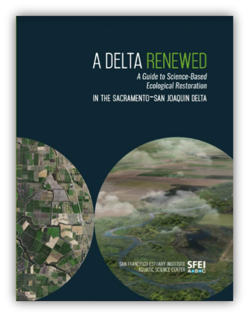
Understanding the importance of the Bay-Delta ecosystem and
working to restore it means grasping the scope of what it once
was.
That’s the takeaway message of a report released Nov. 14 by the
San Francisco Estuary Institute.
The report, “A
Delta Renewed,” is the latest in a series sponsored by the
California Department of Fish and Wildlife (DFW). Written by
several authors, the report says there is “cause for hope” to
achieving large-scale Delta restoration in a way that supports
people, farms and the environment. SFEI calls itself “one of
California’s premier aquatic and ecosystem science institutes.”
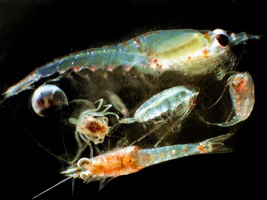
Zooplankton, which are floating
aquatic microorganisms too small and weak to swim against
currents, are are important food sources for many fish species in
the Delta such as salmon, sturgeon and Delta smelt.
This 3-day, 2-night tour, which we do every year,
takes participants to the heart of California water policy – the
Sacramento-San Joaquin Delta and San Francisco Bay.
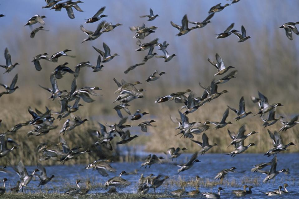
The Pacific Flyway is one of four
major North American migration routes for birds, especially
waterfowl, and extends from Alaska and Canada, through
California, to Mexico and South America. Each year, birds follow
ancestral patterns as they travel the flyway on their annual
north-south migration. Along the way, they need stopover sites
such as wetlands with suitable habitat and food supplies. In
California, 90 percent of historic wetlands have been lost.
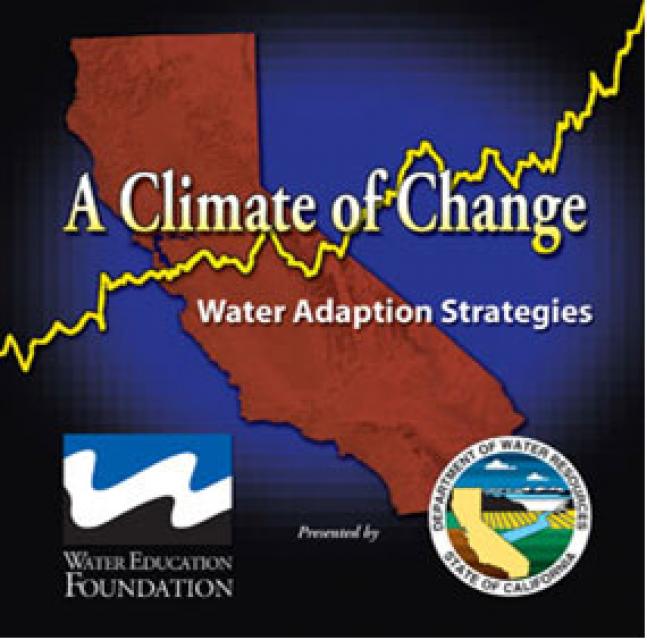
This 25-minute documentary-style DVD, developed in partnership
with the California Department of Water Resources, provides an
excellent overview of climate change and how it is already
affecting California. The DVD also explains what scientists
anticipate in the future related to sea level rise and
precipitation/runoff changes and explores the efforts that are
underway to plan and adapt to climate.
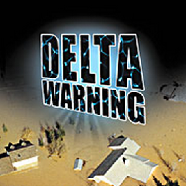
15-minute DVD that graphically portrays the potential disaster
should a major earthquake hit the Sacramento-San Joaquin Delta.
“Delta Warning” depicts what would happen in the event of an
earthquake registering 6.5 on the Richter scale: 30 levee breaks,
16 flooded islands and a 300 billion gallon intrusion of salt
water from the Bay – the “big gulp” – which would shut down the
State Water Project and Central Valley Project pumping plants.
Water truly has shaped California into the great state it is
today. And if it is water that made California great, it’s the
fight over – and with – water that also makes it so critically
important. In efforts to remap California’s circulatory system,
there have been some critical events that had a profound impact
on California’s water history. These turning points not only
forced a re-evaluation of water, but continue to impact the lives
of every Californian. This 2005 PBS documentary offers a
historical and current look at the major water issues that shaped
the state we know today. Includes a 12-page viewer’s guide with
background information, historic timeline and a teacher’s lesson.
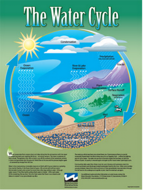
Water as a renewable resource is depicted in this 18×24 inch
poster. Water is renewed again and again by the natural
hydrologic cycle where water evaporates, transpires from plants,
rises to form clouds, and returns to the earth as precipitation.
Excellent for elementary school classroom use.
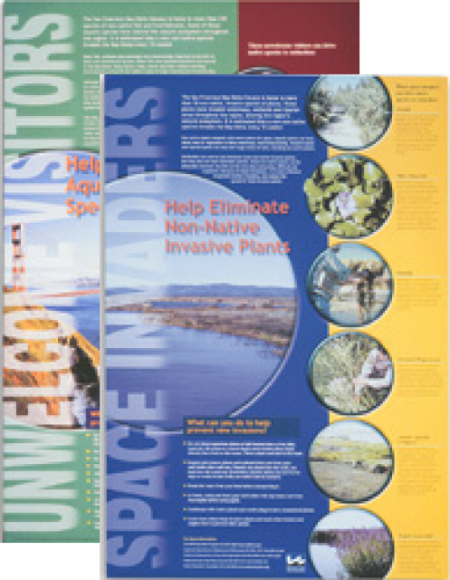
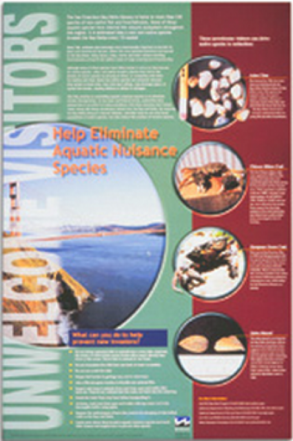
This 24×36 inch poster, suitable for framing, explains how
non-native invasive animals can alter the natural ecosystem,
leading to the demise of native animals. “Unwelcome Visitors”
features photos and information on four such species – including
the zerbra mussel – and explains the environmental and economic
threats posed by these species.
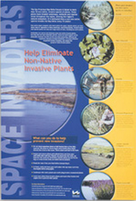
This 24×36 inch poster, suitable for framing, explains how
non-native invasive plants can alter the natural ecosystem,
leading to the demise of native plants and animals. “Space
Invaders” features photos and information on six non-native
plants that have caused widespread problems in the Bay-Delta
Estuary and elsewhere.
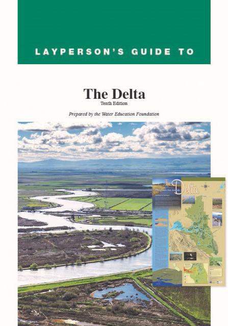
The 24-page Layperson’s Guide to the Delta explores the competing
uses and demands on California’s Sacramento-San Joaquin Delta.
Included in the guide are sections on the history of the Delta,
its role in the state’s water system, and its many complex issues
with sections on water quality, levees, salinity and agricultural
drainage, fish and wildlife, and water distribution.
A new look for our most popular product! And it’s the perfect
gift for the water wonk in your life.
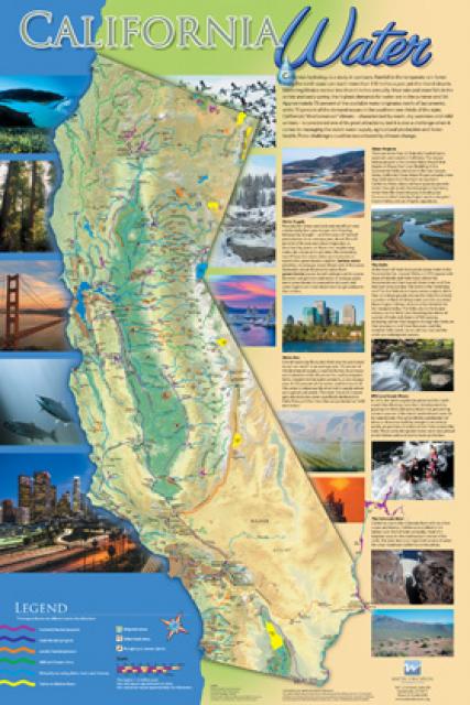
Our 24×36 inch California Water Map is widely known for being the
definitive poster that shows the integral role water plays in the
state. On this updated version, it is easier to see California’s
natural waterways and man-made reservoirs and aqueducts
– including federally, state and locally funded
projects – the wild and scenic rivers system, and
natural lakes. The map features beautiful photos of
California’s natural environment, rivers, water projects,
wildlife, and urban and agricultural uses and the
text focuses on key issues: water supply, water use, water
projects, the Delta, wild and scenic rivers and the Colorado
River.
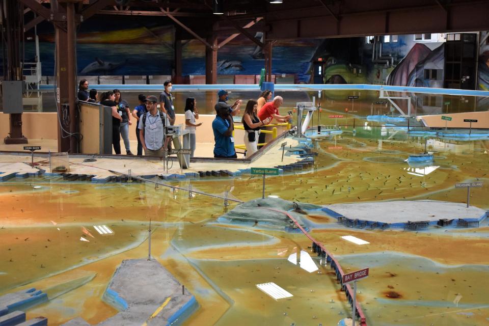
Operated by the U.S. Army Corps of Engineers, the
Bay Model is a giant hydraulic replica of San Francisco
Bay and the Sacramento-San Joaquin
Delta. It is housed in a converted World II-era
warehouse in Sausalito near San Francisco.
Hundreds of gallons of water are pumped through the
three-dimensional, 1.5-acre model to simulate a tidal ebb
and flow lasting 14 minutes.
Invasive species, also known as
exotics, are plants, animals, insects and aquatic species
introduced into non-native habitats.
Often, invasive species travel to non-native areas by ship,
either in ballast water released into harbors or attached to the
sides of boats. From there, introduced species can then spread
and significantly alter ecosystems and the natural food chain as
they go. Another example of non-native species introduction is
the dumping of aquarium fish into waterways.
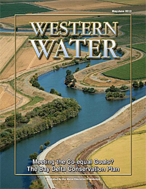
This issue of Western Water looks at the BDCP and the
Coalition to Support Delta Projects, issues that are aimed at
improving the health and safety of the Delta while solidifying
California’s long-term water supply reliability.
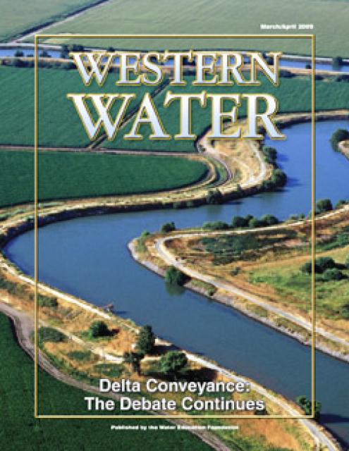
This printed issue of Western Water provides an overview of the
idea of a dual conveyance facility, including questions
surrounding its cost, operation and governance
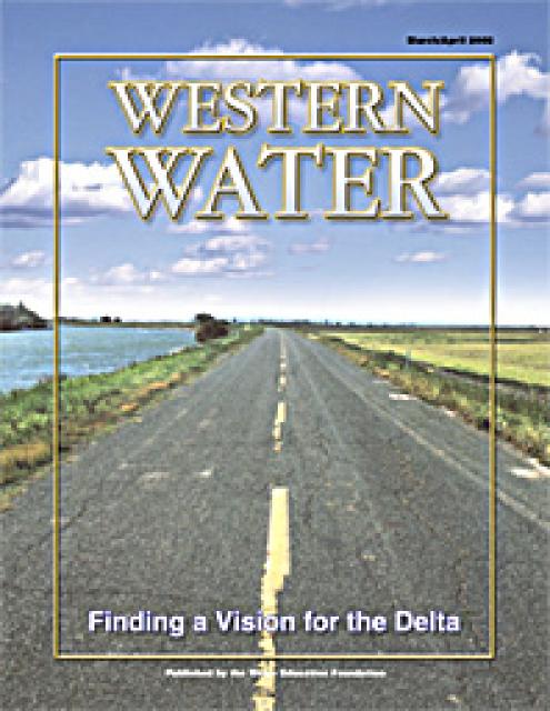
This printed copy of Western Water examines the Delta through the
many ongoing activities focusing on it, most notably the Delta
Vision process. Many hours of testimony, research, legal
proceedings, public hearings and discussion have occurred and
will continue as the state seeks the ultimate solution to the
problems tied to the Delta.


")