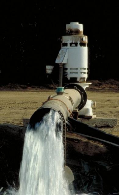
California hosts a substantial, complicated water rights system
that allocates water across the state. In addition to a dual
system — riparian and appropriate rights — today state courts
are recognizing expanded public trust values in determining
how the state’s water resources should be best used.
Water rights are governed mostly by state law. Water quality
issues, which may affect allocation, are regulated separately by
both federal and state laws. Water rights can be quite
contentious.
On April 23, during the administrative public hearing of the
Board of Mesa County Commissioners, they approved a
million-dollar contribution toward the permanent protection of
the most senior, non-consumptive water right on the Colorado
River — the Shoshone water rights. “Mesa County’s $1 million
investment in the Shoshone water rights is not just a financial
commitment, but a pledge to our community’s future,” said
Bobbie Daniel, Chair of the Board of Mesa County Commissioners.
“By safeguarding these rights, Mesa County ensures that the
West Slope’s lifeblood — our beloved Colorado River — continues
to sustain our families, farms, and natural habitats. …”
Farmers in the critically overdrafted Tulare Lake Subbasin in
the San Joaquin Valley are bracing for escalating costs as
state and local agencies assess fees on wells and groundwater
pumped. For the first time, the California State Water
Resources Control Board last week placed the subbasin on
probationary status as part of regulations under the state’s
landmark 2014 Sustainable Groundwater Management Act, or SGMA.
… Kings County Farm Bureau Executive Director Dusty Ference
said new state and local groundwater-related fees will impact
farmers and communities.
Our popular water maps don the
office walls of many in the water world, and our Layperson’s
Guides are the go-to resource for impartial overviews of key
water topics and landmarks across California and the Southwest.
In recognition of Earth Day and National Environmental Education
Week, we’re offering a 20 percent discount
through April 27 on these educational products:
State lawmakers are considering a bill that would let two
energy companies with coal-fired power plants in northwest
Colorado hang on to their water rights even after the plants’
planned closures in 2028. Senate Bill 197 says that industrial
water rights held by Xcel Energy and Tri-State Generation and
Transmission Association Inc. will be protected from
abandonment through 2050. Under Colorado law, a water right
that is not being used could end up on an abandonment list,
which is compiled every 10 years. Abandonment is the official
term for one of Colorado’s best-known water adages: Use it or
lose it. It means that the right to use the water is
essentially canceled and ceases to exist. The water goes back
into the stream where another water user can claim it.
The recently announced closure of the salmon fishing season
delivered yet another devastating blow to the thousands of
families that depend on commercial and recreational fishing for
their livelihoods. For the second year in a row, fishing boats
at Fisherman’s Wharf will remain mothballed. The recent drought
contributed to the salmon decline, but the larger problem is
archaic water policies that allow too much water to be diverted
from our rivers and the Delta. As a result, salmon experience
manmade droughts almost every year, and the droughts we notice
become mega-droughts for fish. … California desperately needs
water reform, but strong opposition has come from what might
seem like an unlikely suspect. The San Francisco Public
Utilities Commission, which manages our Hetch Hetchy Water
System, is one of the worst culprits when it comes to poor
stewardship of our aquatic ecosystems. -Written by Peter Drekmeier, Policy Director for
the Tuolumne River Trust; and Scott Artis; Executive
Director of the Golden State Salmon Association.
The mainstream media continues its obsession with the amount of
water that goes to producing alfalfa and other important forage
crops in the West. The Colorado River right now is
understandably a favorite topic of environmental journalists,
as state, federal and tribal decision-makers are scrambling to
negotiate a long-term river operating agreement to replace the
current one that expires in 2026. Those arguments were teed up
again last month when the Los Angeles Times broadcast a recent
study showing that agriculture is the “dominant” user of
Colorado River water, “about three times the combined usage of
all the cities that depend on the river”. Unfortunately, not a
single Colorado River farmer or water manager was mentioned in
that story. -Written by Dan Keppen, executive director of the Family
Farm Alliance.
Proposed state legislation to modify California’s longstanding
farmland conservation law could pave the way for large swaths
of farm acreage to be repurposed as sites for renewable energy
projects. The California Land Conservation Act of 1965,
commonly known as the Williamson Act, preserves farmland by
assessing property taxes based on the land’s agricultural value
rather than its full market value. Landowners with Williamson
Act contracts, which cover about half the state’s 30 million
acres of farm and ranchland, generally see a 20% to 75%
reduction in property taxes. … The proposed legislation
seeks to align the state’s renewable energy and groundwater
management goals. California’s Sustainable Groundwater
Management Act, or SGMA, requires users to bring groundwater
basins into balance within the next two decades.
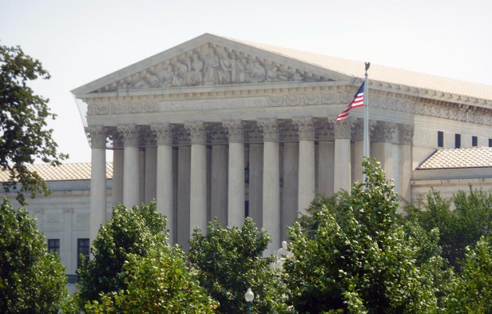
After waiting 14 years, water rights protestants to a 2009
proceeding have filed a complaint against the State Water
Resources Control Board alleging it has given preferential
treatment to the Department of Water Resources (DWR) regarding
antiquated water rights claims. They also said the board failed
to implement state laws requiring the reasonable and equitable
development of water diversions and the protection of water
resources in the State. … The complaint alleges that DWR
has failed to comply with state water rights law requiring
water rights be timely put to full beneficial use; the
purpose of this requirement is to safeguard the public
interest.
The governance of San Francisco Bay/Sacramento-San Joaquin
Delta water quality falls under the authority of the State
Water Quality Control Board. Among other duties, the Water
Board is responsible for adopting and updating the Bay-Delta
Water Quality Control Plan for the San Francisco
Bay/Sacramento-San Joaquin Delta Estuary (Bay-Delta
Plan). The Bay-Delta Plan’s purpose sets forth measures
and flow requirements to safeguard various water uses within
the watershed, including municipal, industrial, agricultural,
and ecological needs. Comprising five political appointees with
extensive powers, the Water Board plays a pivotal role in
shaping California’s water management policies. -Written by Cary Keaten, the general manager of
the Solano Irrigation District.
The Bureau of Reclamation today announced the initial 2024
water supply allocations for the Klamath Project along with
$8.5 million in immediate funding for the Klamath Basin
communities to support drought resiliency and $5 million for
Klamath Basin tribes impacted by drought. In partnership with
the Klamath Project Drought Response Agency, Reclamation has
secured $8.5 million for administration of specifically
authorized drought resiliency programs targeted for project
contractors who receive a reduced water allocation. Reclamation
is announcing this funding together with an additional $5
million from separate program sources which will be disbursed
through technical assistance agreements with Klamath Basin
Tribal Nations for drought and ecosystem activities.
… The federal government’s current approach to this imbalance
is the equivalent of trying to cure cancer with a Band-Aid.
Instead of pursuing a long-term solution, Washington is using
federal funds to pay states and tribal nations to leave water
in the river instead of taking their full allocation. Mostly,
that means paying farmers to stop farming. That is not a viable
long-term solution, and strategically, we need to be
encouraging MORE local farming and food production, not less.
It does make sense to assist local farmers in switching to
crops that require less water, but it does not make sense to
put American farmers out of business and make us more reliant
on food trucked or shipped thousands of miles before it arrives
on our tables. -Written by Arizona Republican Kari Lake, who is running
for the U.S. Senate.
… This year Western Slope leaders, led by the Colorado River
District, struck a $99 million deal to buy a tiny hydro plant’s
water rights from Xcel Energy and lease the water back to Xcel
to generate electricity. As part of the deal, Shoshone’s rights
would become the largest, most influential environmental water
right in state history. The change would protect fish and
habitat, but it would also beef up water security on the
Western Slope by protecting reliable westward flows for farmers
and tourist economies. … The Colorado River District’s
plan has drawn hawk-eyed attention from water players around
the state who are keen on protecting their supplies.
Klamath, Modoc and Siskiyou County leaders are asking for an
“adequate water supply” on behalf of local irrigation. A news
release from Klamath Water Users Association this week said a
letter has been sent to the Bureau of Reclamation requesting
the full water allocations on behalf of Klamath Project
irrigators. The letter, sent to Reclamation Commissioner
Camille Calimlim Touton, bases the request for increase water
flows in congruence with “favorably hydrology” this year in the
Klamath Basin.
Are you a water rightsholder? Have you filed your Annual Water
Diversion and Use reports for Water Year 2023? If you answered
“yes” then “no,” a notice of violation could be on the way.
It’s just been announced that the Division of Water Rights will
be sending Notices of Violation in the next few weeks for those
who have not submitted the annual reports or statements. Those
were due before February 1. According to the Board, if you
submit your past-due report promptly, you will not receive the
notice and potential future enforcement action. There is a help
website that has been set up in an attempt to walk
rightsholders through the process. You can access that at
https://shorturl.at/xNY28.
Water access in California has seen growing scrutiny as the
climate shifts from more extreme dry to wet swings. This
results in increasing year-to-year uncertainty for both
commercial and residential water availability. One area getting
more attention from an ethical and practical application is the
system of water rights, which first took shape in the late
1800s.
Water is a crucial topic in the American Southwest, as
continued drought and cuts to Colorado River water allocations
make more urgent the policy decisions on the future of water in
the region. Gaps in water policies have historically left
tribal communities with limited access to clean water and
infrastructure, a situation that Cora Tso is working to
correct. Tso, a new senior research fellow with the Kyl Center
for Water Policy at Arizona State University’s Morrison
Institute, is particularly well-suited to address tribal water
policy issues as both a lawyer specializing in Indian and water
law and an enrolled member of the Navajo Nation. She aims to
share her expertise with others, both through an assessment
tool she is creating and an upcoming free webinar on tribal
water issues April 9 that is open to the public…. Tso
was recently recognized as a Colorado River Water
Leader by the Water Education Foundation
and has strong ambitions as she continues in her career.
In December 2018 the State Water Resources Control Board (State
Board) adopted updates to the Bay-Delta Plan (Plan) in
accordance with its obligations under the Porter-Cologne Act.
The updated Plan included flow objectives intended to restore
and protect Chinook salmon and Central Valley steelhead in the
lower San Joaquin River and its tributaries. Twelve lawsuits
and 116 claims were filed challenging the State Board’s updated
Plan. On March 15, 2024, Sacramento County Superior Court Judge
Stephen Acquisto rejected all lawsuits and claims. To some
degree the court’s decision is a win for California’s
fisheries, but the decision also affirmed the discretionary
right of the State Board to keep less water in rivers than
needed to restore fisheries and aquatic ecosystems.
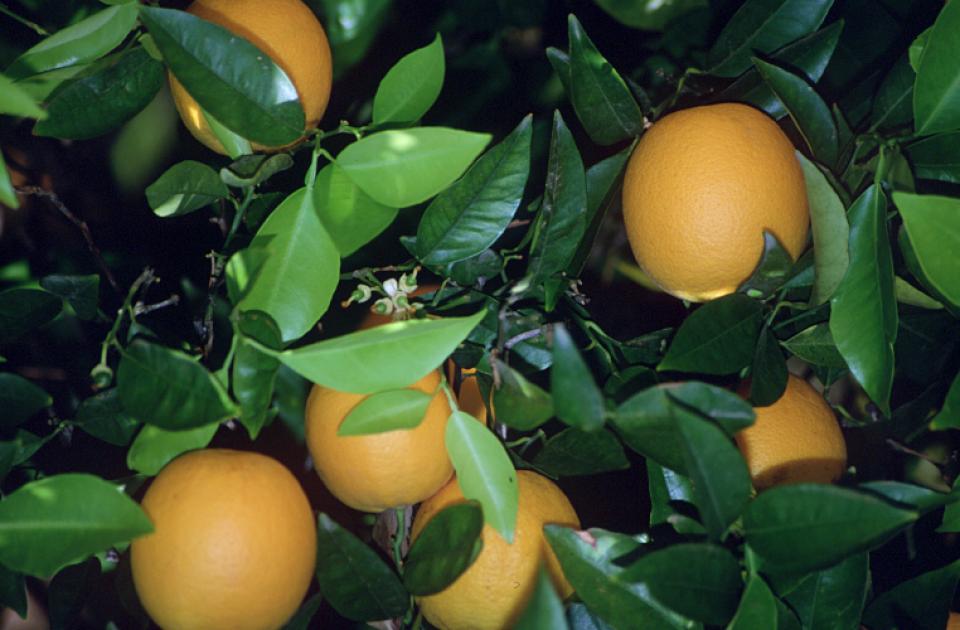
For a place where nature didn’t intend lettuce to grow, the
southwest corner of Arizona has built a spectacular record as
“America’s salad bowl.” Thanks to copious irrigation and
decades of public investment, Yuma and the bordering Imperial
Valley of California supply as much as 90 percent of the
nation’s salad greens during the winter, making the area
pivotal to the debate over the future of American agriculture
in an era of oppressive weather made worse by the changing
climate.
In the Records Room of the CalEPA building in Sacramento are
some of the most important documents in the entire state of
California. Some date back to 1914. “Our files are organized in
ascending order,” explained Matthew Jay, an analyst with the
State Water Resources Control Board. “The oldest documents are
at the bottom and so you can see that some of the stuff is all
typewritten and in a lot of cases, handwritten.” … The
papers are what’s known as water rights – the backbone of life
in California and its multitrillion dollar economy. Water
rights are official documents validating who has the authority
to take water, from where, and how much of it.
Karrigan Börk, UC Davis professor of law and Associate Director
at the Center for Watershed Sciences, has been awarded the
prestigious $10,000 Morrison Prize for his paper on water
rights. The Sandra Day O’Connor College of Law at Arizona State
University recognizes Börk’s paper as “the most impactful
sustainability-related legal academic paper published in North
America” for 2023. Börk’s winning paper, “Water Exaction
Rights,” published in the Harvard Environmental Law Review,
proposes a solution to address current and future water crises
in the US: an exactions framework.
Two-thirds of the tribes with lands and water rights in the
Colorado River Basin are calling for equal status in developing
new river management guidelines and protection of their senior
water rights against proposed cuts or caps on developing their
water. Leaders from 20 tribes, including eight in Arizona, sent
a letter to the U.S. Bureau of Reclamation March 11. In the
letter, obtained by The Arizona Republic, the tribes outlined
what they expect in new river management guidelines that will
take effect when the current guidelines expire Dec. 31, 2026.
The two tribes with Arizona’s largest river allocations — the
Colorado River Indian Tribes, which holds senior rights to
720,000 acre-feet of water, mostly in Arizona, and the Gila
River Indian Community, with 653,000 acre-feet of Colorado
River and other waters — did not sign the letter.
In a Sacramento office building, university students carefully
scan pieces of paper that underpin California’s most
contentious and valuable water disputes. One by one, they’re
bringing pieces of history into the digital era, some a century
old and thin as onion skin. The student workers are beginning
to digitize the state’s water rights records, part of a project
launched by the state’s water regulator earlier this year. It
may seem simple, but scanning two million musty pages is part
of a $60 million project that could take years. The massive
undertaking will unmask the notoriously opaque world of
California water. Right now, it’s practically impossible to
know who has the right to use water, how much they’re taking
and from what river or stream at any given time in the state.
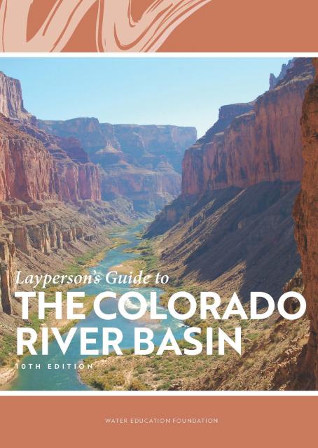
Learn the history and challenges facing the West’s most dramatic
and developed river.
The Layperson’s Guide to the Colorado River Basin introduces the
1,450-mile river that sustains 40 million people and millions of
acres of farmland spanning seven states and parts of northern
Mexico.
The 28-page primer explains how the river’s water is shared and
managed as the Southwest transitions to a hotter and drier
climate.
… In California, just figuring out who holds a water right
requires a trip to a downtown Sacramento storage room crammed
with millions of paper and microfilmed records dating to the
mid-1800s. Even the state’s water rights enforcers struggle to
determine who is using what. … Come next year, however,
the board expects to have all records electronically accessible
to the public. Officials recently started scanning records tied
to an estimated 45,000 water rights into an online database.
They’re also designing a system that will give real-time data
on how much water is being diverted from rivers and streams
across the state. … Proponents say the information
technology upgrade will help the state and water users better
manage droughts, establish robust water trading markets and
ensure water for fish and the environment.
For a state that prides itself on
technological innovation, California is surprisingly antiquated
when it comes to accessing fundamental facts about its most
critical natural resource – water.
Most anywhere else in the West, basic water rights information
such as who is using how much water, for what purpose, when, and
where can be pulled up on a laptop or smartphone.
The climate-driven shrinking of the
Colorado River is expanding the influence of Native American
tribes over how the river’s flows are divided among cities, farms
and reservations across the Southwest.
The tribes are seeing the value of their largely unused river
water entitlements rise as the Colorado dwindles, and they are
gaining seats they’ve never had at the water bargaining table as
government agencies try to redress a legacy of exclusion.
Below-average precipitation and snowpack during 2020-22 and
depleted surface and groundwater supplies pushed California
into a drought emergency that brought curtailment orders and
calls for modernizing water rights. At the Water Education
Foundation annual water summit last week in Sacramento,
Eric Oppenheimer, chief deputy director of the California State
Water Resources Control Board, discussed what he described as
the state’s “antiquated” water rights system. He spoke before
some 150 water managers, government officials, farmers,
environmentalists and others as part of the event where
interests come together to collaborate on some of the state’s
most challenging water issues.
The states of the Lower Colorado
River Basin have traditionally played an oversized role in
tapping the lifeline that supplies 40 million people in the West.
California, Nevada and Arizona were quicker to build major canals
and dams and negotiated a landmark deal that requires the Upper
Basin to send predictable flows through the Grand Canyon, even
during dry years.
But with the federal government threatening unprecedented water
cuts amid decades of drought and declining reservoirs, the Upper
Basin states of Wyoming, Utah, Colorado and New Mexico are
muscling up to protect their shares of an overallocated river
whose average flows in the Upper Basin have already dropped
20 percent over the last century.
They have formed new agencies to better monitor their interests,
moved influential Colorado River veterans into top negotiating
posts and improved their relationships with Native American
tribes that also hold substantial claims to the river.
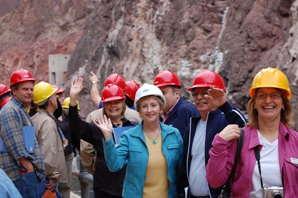
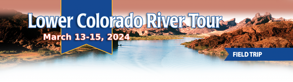
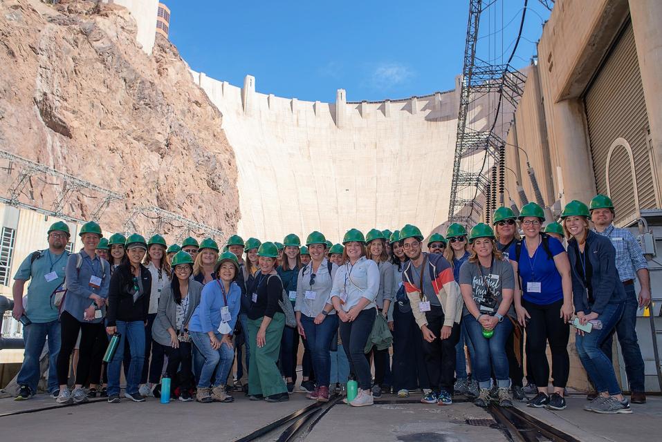
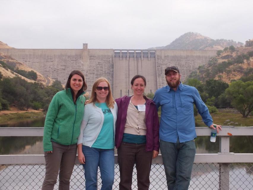
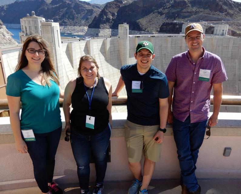
This tour explored the lower Colorado River firsthand where virtually every drop of the river is allocated, yet demand is growing from myriad sources — increasing population, declining habitat, drought and climate change.
The 1,450-mile river is a lifeline to some 40 million people in the Southwest across seven states, 30 tribal nations and Mexico. How the Lower Basin states – Arizona, California and Nevada – use and manage this water to meet agricultural, urban, environmental and industrial needs was the focus of this tour.
Hilton Garden Inn Las Vegas Strip South
7830 S Las Vegas Blvd
Las Vegas, NV 89123
It was exactly the sort of deluge
California groundwater agencies have been counting on to
replenish their overworked aquifers.
The start of 2023 brought a parade of torrential Pacific storms
to bone dry California. Snow piled up across the Sierra Nevada at
a near-record pace while runoff from the foothills gushed into
the Central Valley, swelling rivers over their banks and filling
seasonal creeks for the first time in half a decade.
Suddenly, water managers and farmers toiling in one of the
state’s most groundwater-depleted regions had an opportunity to
capture stormwater and bank it underground. Enterprising agencies
diverted water from rushing rivers and creeks into manmade
recharge basins or intentionally flooded orchards and farmland.
Others snagged temporary permits from the state to pull from
streams they ordinarily couldn’t touch.
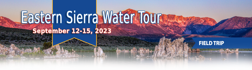
This special Foundation water tour journeyed along the Eastern Sierra from the Truckee River to Mono Lake, through the Owens Valley and into the Mojave Desert to explore a major source of water for Southern California, this year’s snowpack and challenges for towns, farms and the environment.
When the Colorado River Compact was
signed 100 years ago, the negotiators for seven Western states
bet that the river they were dividing would have ample water to
meet everyone’s needs – even those not seated around the table.
A century later, it’s clear the water they bet on is not there.
More than two decades of drought, lake evaporation and overuse of
water have nearly drained the river’s two anchor reservoirs, Lake
Powell on the Arizona-Utah border and Lake Mead near Las Vegas.
Climate change is rendering the basin drier, shrinking spring
runoff that’s vital for river flows, farms, tribes and cities
across the basin – and essential for refilling reservoirs.
The states that endorsed the Colorado River Compact in 1922 – and
the tribes and nation of Mexico that were excluded from the table
– are now straining to find, and perhaps more importantly accept,
solutions on a river that may offer just half of the water that
the Compact assumed would be available. And not only are
solutions not coming easily, the relationships essential for
compromise are getting more frayed.
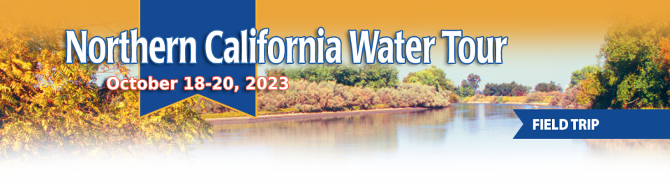
This tour explored the Sacramento River and its tributaries through a scenic landscape while learning about the issues associated with a key source for the state’s water supply.
All together, the river and its tributaries supply 35 percent of California’s water and feed into two major projects: the State Water Project and the federal Central Valley Project.
Water Education Foundation
2151 River Plaza Drive, Suite 205
Sacramento, CA 95833
As water interests in the Colorado
River Basin prepare to negotiate a new set of operating
guidelines for the drought-stressed river, Amelia Flores wants
her Colorado River Indian Tribes (CRIT) to be involved in the
discussion. And she wants CRIT seated at the negotiating table
with something invaluable to offer on a river facing steep cuts
in use: its surplus water.
CRIT, whose reservation lands in California and Arizona are
bisected by the Colorado River, has some of the most senior water
rights on the river. But a federal law enacted in the late 1700s,
decades before any southwestern state was established, prevents
most tribes from sending any of its water off its reservation.
The restrictions mean CRIT, which holds the rights to nearly a
quarter of the entire state of Arizona’s yearly allotment of
river water, is missing out on financial gain and the chance to
help its river partners.
This tour explored the Sacramento River and its tributaries
through a scenic landscape while learning about the issues
associated with a key source for the state’s water supply.
All together, the river and its tributaries supply 35 percent of
California’s water and feed into two major projects: the State
Water Project and the federal Central Valley Project.
Water Education Foundation
2151 River Plaza Drive, Suite 205
Sacramento, CA 95833
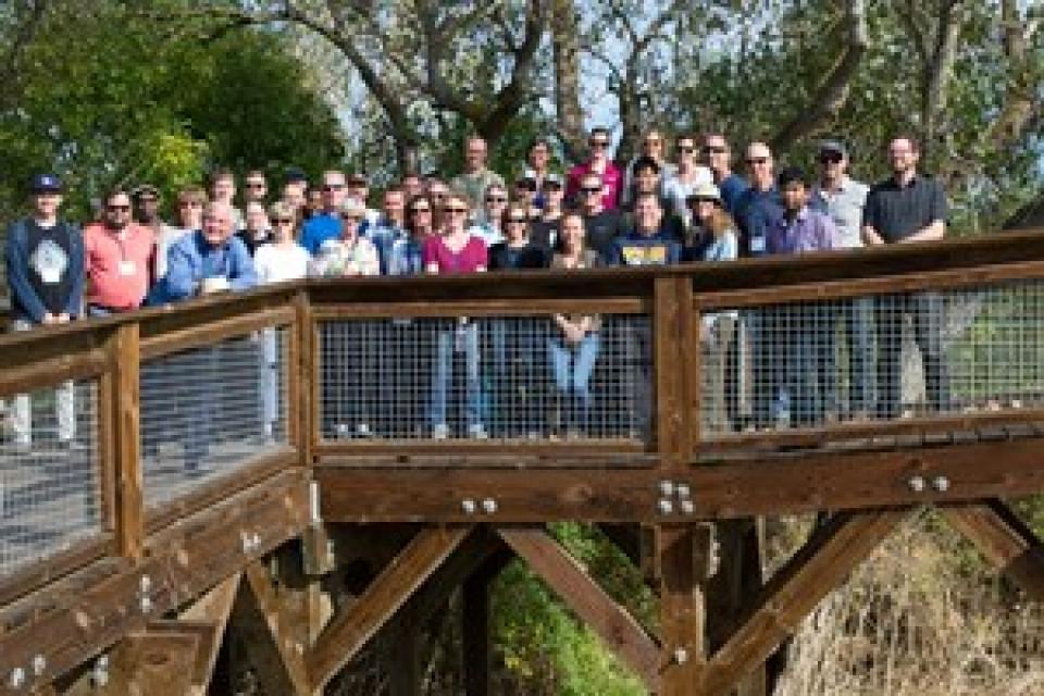
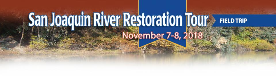
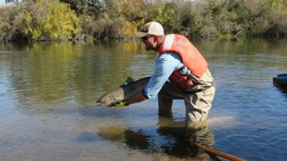
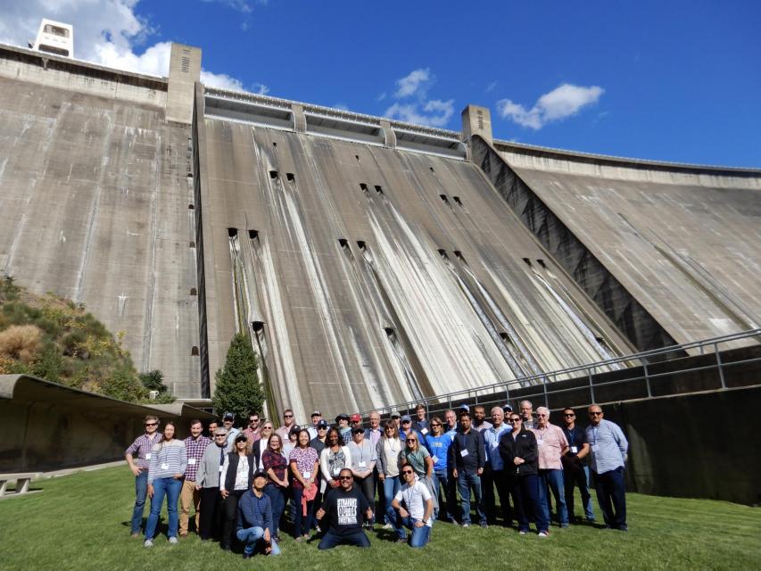
This tour traveled along the San Joaquin River to learn firsthand
about one of the nation’s largest and most expensive river
restoration projects.
The San Joaquin River was the focus of one of the most
contentious legal battles in California water history,
ending in a 2006 settlement between the federal government,
Friant Water Users Authority and a coalition of environmental
groups.
Hampton Inn & Suites Fresno
327 E Fir Ave
Fresno, CA 93720
Momentum is building for a unique
interstate deal that aims to transform wastewater from Southern
California homes and business into relief for the stressed
Colorado River. The collaborative effort to add resiliency to a
river suffering from overuse, drought and climate change is being
shaped across state lines by some of the West’s largest water
agencies.
This tour explored the lower Colorado River firsthand where virtually every drop of the river is allocated, yet demand is growing from myriad sources — increasing population, declining habitat, drought and climate change.
The 1,450-mile river is a lifeline to some 40 million people in the Southwest across seven states, 30 tribal nations and Mexico. How the Lower Basin states – Arizona, California and Nevada – use and manage this water to meet agricultural, urban, environmental and industrial needs was the focus of this tour.
Hyatt Place Las Vegas At Silverton Village
8380 Dean Martin Drive
Las Vegas, NV 89139
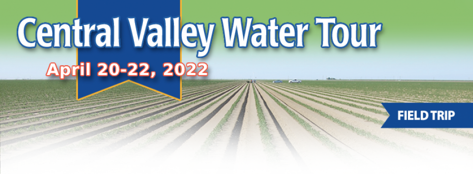
This tour ventured through California’s Central Valley, known as the nation’s breadbasket thanks to an imported supply of surface water and local groundwater. Covering about 20,000 square miles through the heart of the state, the valley provides 25 percent of the nation’s food, including 40 percent of all fruits, nuts and vegetables consumed throughout the country.
Climate scientist Brad Udall calls
himself the skunk in the room when it comes to the Colorado
River. Armed with a deck of PowerPoint slides and charts that
highlight the Colorado River’s worsening math, the Colorado State
University scientist offers a grim assessment of the river’s
future: Runoff from the river’s headwaters is declining, less
water is flowing into Lake Powell – the key reservoir near the
Arizona-Utah border – and at the same time, more water is being
released from the reservoir than it can sustainably provide.
The lower Colorado River has virtually every drop allocated, yet demand is growing from myriad sources — increasing population, declining habitat, drought and climate change.
The 1,450-mile river is a lifeline to 40 million people in the Southwest across seven states, 30 tribal nations and Mexico. How the Lower Basin states – Arizona, California and Nevada – use and manage this water to meet agricultural, urban, environmental and industrial needs was the focus of this tour.
Hyatt Place Las Vegas At Silverton Village
8380 Dean Martin Drive
Las Vegas, NV 89139
This tour guided participants on a virtual exploration of the Sacramento River and its tributaries and learn about the issues associated with a key source for the state’s water supply.
All together, the river and its tributaries supply 35 percent of California’s water and feed into two major projects: the State Water Project and the federal Central Valley Project.
As California’s seasons become
warmer and drier, state officials are pondering whether the water
rights permitting system needs revising to better reflect the
reality of climate change’s effect on the timing and volume of
the state’s water supply.
A report by the State Water Resources Control Board recommends
that new water rights permits be tailored to California’s
increasingly volatile hydrology and be adaptable enough to ensure
water exists to meet an applicant’s demand. And it warns
that the increasingly whiplash nature of California’s changing
climate could require existing rights holders to curtail
diversions more often and in more watersheds — or open
opportunities to grab more water in climate-induced floods.
This event explored the lower Colorado River where virtually every drop of the river is allocated, yet demand is growing from myriad sources — increasing population, declining habitat, drought and climate change.
The 1,450-mile river is a lifeline to 40 million people in the Southwest across seven states and Mexico. How the Lower Basin states – Arizona, California and Nevada – use and manage this water to meet agricultural, urban, environmental and industrial needs was the focus of this tour.
Dates are now set for two key
Foundation events to kick off 2020 — our popular Water 101
Workshop, scheduled for Feb. 20 at McGeorge School of Law in
Sacramento, and our Lower Colorado River Tour, which will run
from March 11-13.
In addition, applications will be available by the first week of
October for our 2020 class of Water Leaders, our competitive
yearlong program for early to mid-career up-and-coming water
professionals. To learn more about the program, check out our
Water Leaders program
page.
This tour explored the lower Colorado River where virtually every drop of the river is allocated, yet demand is growing from myriad sources — increasing population, declining habitat, drought and climate change.
The 1,450-mile river is a lifeline to 40 million people in the Southwest across seven states and Mexico. How the Lower Basin states – Arizona, California and Nevada – use and manage this water to meet agricultural, urban, environmental and industrial needs is the focus of this tour.
Silverton Hotel
3333 Blue Diamond Road
Las Vegas, NV 89139
This 2-day, 1-night tour offered participants the opportunity to
learn about water issues affecting California’s scenic Central
Coast and efforts to solve some of the challenges of a region
struggling to be sustainable with limited local supplies that
have potential applications statewide.
As the Colorado River Basin becomes
drier and shortage conditions loom, one great variable remains:
How much of the river’s water belongs to Native American tribes?
Native Americans already use water from the Colorado River and
its tributaries for a variety of purposes, including leasing it
to non-Indian users. But some tribes aren’t using their full
federal Indian reserved water right and others have water rights
claims that have yet to be resolved. Combined, tribes have rights
to more water than some states in the Colorado River Basin.
In 1983, a landmark California Supreme Court ruling extended the public trust doctrine to tributary creeks that feed Mono Lake, which is a navigable water body even though the creeks themselves were not. The ruling marked a dramatic shift in water law and forced Los Angeles to cut back its take of water from those creeks in the Eastern Sierra to preserve the lake.
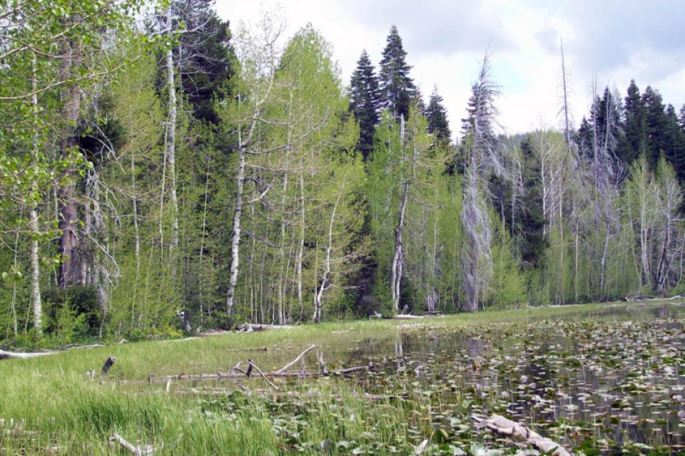
Now, a state appellate court has for the first time extended that same public trust doctrine to groundwater that feeds a navigable river, in this case the Scott River flowing through a picturesque valley of farms and alfalfa in Siskiyou County in the northern reaches of California.
This tour explored the Sacramento River and its tributaries
through a scenic landscape as participants learned about the
issues associated with a key source for the state’s water supply.
All together, the river and its tributaries supply 35 percent of
California’s water and feed into two major projects: the State
Water Project and the federal Central Valley Project. Tour
participants got an on-site update of Oroville Dam spillway
repairs.
For decades, cannabis has been grown
in California – hidden away in forested groves or surreptitiously
harvested under the glare of high-intensity indoor lamps in
suburban tract homes.
In the past 20 years, however, cannabis — known more widely as
marijuana – has been moving from being a criminal activity to
gaining legitimacy as one of the hundreds of cash crops in the
state’s $46 billion-dollar agriculture industry, first legalized
for medicinal purposes and this year for recreational use.
We explored the lower Colorado River where virtually every drop
of the river is allocated, yet demand is growing from myriad
sources — increasing population, declining habitat, drought and
climate change.
The 1,450-mile river is a lifeline to 40 million people in
the Southwest across seven states and Mexico. How the Lower Basin
states – Arizona, California and Nevada – use and manage this
water to meet agricultural, urban, environmental and industrial
needs was the focus of this tour.
Hampton Inn Tropicana
4975 Dean Martin Drive, Las Vegas, NV 89118
Does California need to revamp the way in which water is dedicated to the environment to better protect fish and the ecosystem at large? In the hypersensitive world of California water, where differences over who gets what can result in epic legislative and legal battles, the idea sparks a combination of fear, uncertainty and promise.
Saying that the way California manages water for the environment “isn’t working for anyone,” the Public Policy Institute of California (PPIC) shook things up late last year by proposing a redesigned regulatory system featuring what they described as water ecosystem plans and water budgets with allocations set aside for the environment.
This three-day, two-night tour explored the lower Colorado River
where virtually every drop of the river is allocated, yet demand
is growing from myriad sources — increasing population,
declining habitat, drought and climate change.
The 1,450-mile river is a lifeline to 40 million people in
the Southwest across seven states and Mexico. How the Lower Basin
states – Arizona, California and Nevada – use and manage this
water to meet agricultural, urban, environmental and industrial
needs is the focus of this tour.
Best Western McCarran Inn
4970 Paradise Road
Las Vegas, NV 89119
This tour explored the Sacramento River and its tributaries
through a scenic landscape as participants learned about the
issues associated with a key source for the state’s water supply.
All together, the river and its tributaries supply 35 percent of
California’s water and feed into two major projects: the State
Water Project and the federal Central Valley Project. Tour
participants got an on-site update of repair efforts on the
Oroville Dam spillway.
Participants of this tour snaked along the San Joaquin River to
learn firsthand about one of the nation’s largest and most
expensive river restoration projects.
The San Joaquin River was the focus of one of the most
contentious legal battles in California water history,
ending in a 2006 settlement between the federal government,
Friant Water Users Authority and a coalition of environmental
groups.
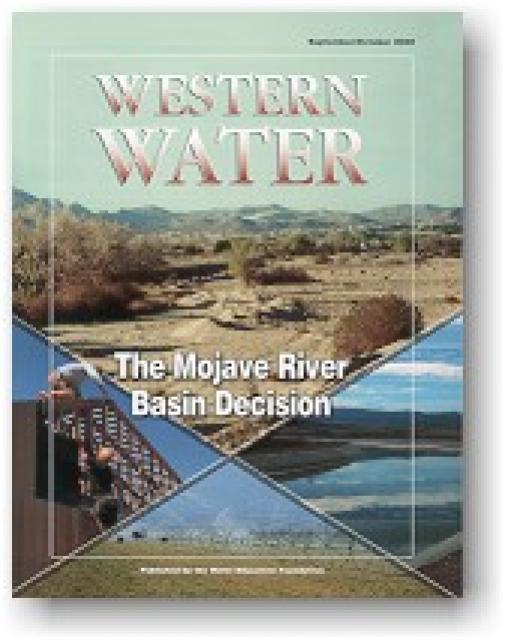
Flowing into the heart of the Mojave Desert, the Mojave River
exists mostly underground. Surface channels are usually dry
absent occasional groundwater surfacing and flooding
from extreme weather events like El Niño.
This issue looks at how California’s severe drought has put its
water rights system under scrutiny, raising the question whether
a complete overhaul is necessary to better allocate water use.
California’s severe drought has put its water rights system under
scrutiny, raising the question whether a complete overhaul is
necessary to better allocate water use.
(Read the excerpt below from the July/August 2015 issue along
with the editor’s note. Click here
to subscribe to Western Water and get full access.)
Introduction
California’s severe drought has put its water rights system under
scrutiny, raising the question whether a complete overhaul is
necessary to better allocate water use.
Before attorneys wrangled in courtrooms over questions of water
rights, people typically took matters into their own hands. If
your neighbor up river was damming water that affected your
supply, it wasn’t unheard of that you would simply sneak up in
the middle of the night and blow up the dam.
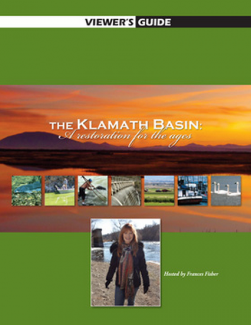
20-minute version of the 2012 documentary The Klamath Basin: A
Restoration for the Ages. This DVD is ideal for showing at
community forums and speaking engagements to help the public
understand the complex issues related to complex water management
disputes in the Klamath River Basin. Narrated by actress Frances
Fisher.
For over a century, the Klamath River Basin along the Oregon and
California border has faced complex water management disputes. As
relayed in this 2012, 60-minute public television documentary
narrated by actress Frances Fisher, the water interests range
from the Tribes near the river, to energy producer PacifiCorp,
farmers, municipalities, commercial fishermen, environmentalists
– all bearing legitimate arguments for how to manage the water.
After years of fighting, a groundbreaking compromise may soon
settle the battles with two epic agreements that hold the promise
of peace and fish for the watershed. View an excerpt from the
documentary here.
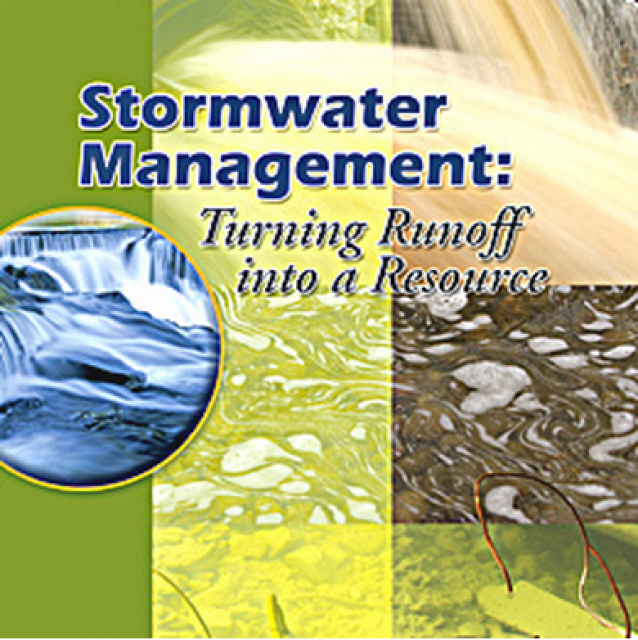
20-minute DVD that explains the problem with polluted stormwater,
and steps that can be taken to help prevent such pollution and
turn what is often viewed as a “nuisance” into a water resource
through various activities.
Many Californians don’t realize that when they turn on the
faucet, the water that flows out could come from a source close
to home or one hundreds of miles away. Most people take their
water for granted; not thinking about the elaborate systems and
testing that go into delivering clean, plentiful water to
households throughout the state. Where drinking water comes from,
how it’s treated, and what people can do to protect its quality
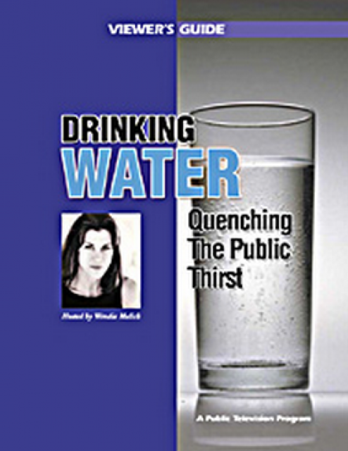
are highlighted in this 2007 PBS documentary narrated by actress
Wendie Malick.
A 30-minute version of the 2007 PBS documentary Drinking Water:
Quenching the Public Thirst. This DVD is ideal for showing at
community forums and speaking engagements to help the public
understand the complex issues surrounding the elaborate systems
and testing that go into delivering clean, plentiful water to
households throughout the state.
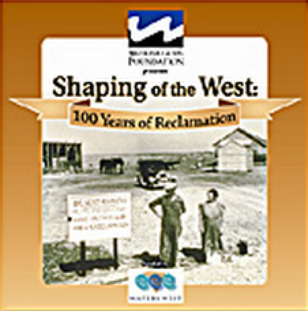
30-minute DVD that traces the history of the U.S. Bureau of
Reclamation and its role in the development of the West. Includes
extensive historic footage of farming and the construction of
dams and other water projects, and discusses historic and modern
day issues.
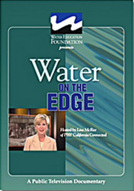
Water truly has shaped California into the great state it is
today. And if it is water that made California great, it’s the
fight over – and with – water that also makes it so critically
important. In efforts to remap California’s circulatory system,
there have been some critical events that had a profound impact
on California’s water history. These turning points not only
forced a re-evaluation of water, but continue to impact the lives
of every Californian. This 2005 PBS documentary offers a
historical and current look at the major water issues that shaped
the state we know today. Includes a 12-page viewer’s guide with
background information, historic timeline and a teacher’s lesson.
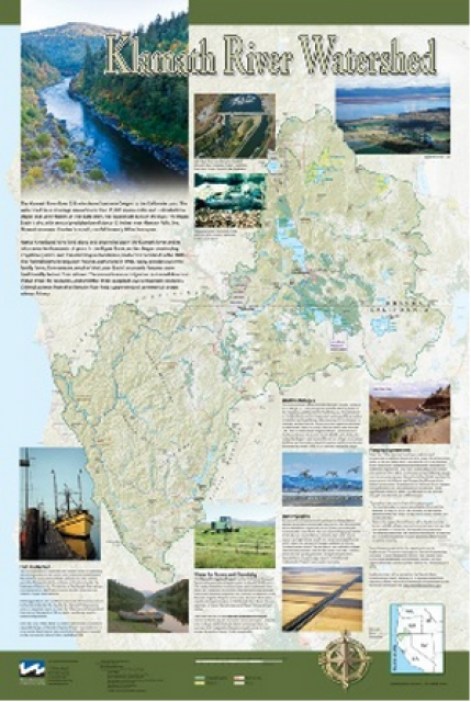
This beautiful 24×36 inch poster, suitable for framing, displays
the rivers, lakes and reservoirs, irrigated farmland, urban areas
and Indian reservations within the Klamath River Watershed. The
map text explains the many issues facing this vast,
15,000-square-mile watershed, including fish restoration;
agricultural water use; and wetlands. Also included are
descriptions of the separate, but linked, Klamath Basin
Restoration Agreement and the Klamath Hydroelectric Agreement,
and the next steps associated with those agreements. Development
of the map was funded by a grant from the U.S. Fish and Wildlife
Service.
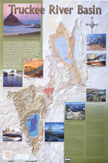
This beautiful 24×36 inch poster, suitable for framing, displays
the rivers, lakes and reservoirs, irrigated farmland, urban areas
and Indian reservations within the Truckee River Basin, including
the Newlands Project, Pyramid Lake and Lake Tahoe. Map text
explains the issues surrounding the use of the Truckee-Carson
rivers, Lake Tahoe water quality improvement efforts, fishery
restoration and the effort to reach compromise solutions to many
of these issues.
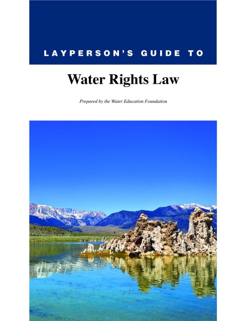
The 28-page Layperson’s Guide to Water Rights Law, recognized as
the most thorough explanation of California water rights law
available to non-lawyers, traces the authority for water flowing
in a stream or reservoir, from a faucet or into an irrigation
ditch through the complex web of California water rights.
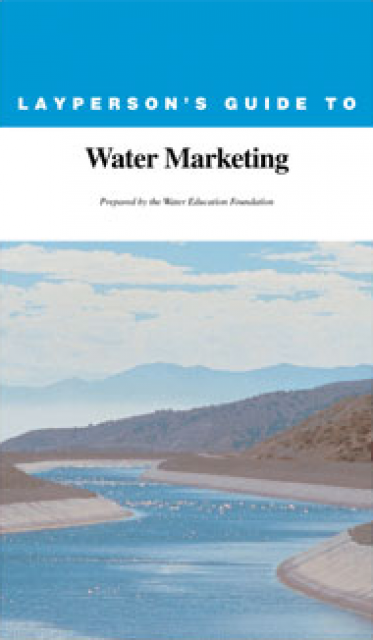
The 20-page Layperson’s Guide to Water Marketing provides
background information on water rights, types of transfers and
critical policy issues surrounding this topic. First published in
1996, the 2005 version offers expanded information on
groundwater banking and conjunctive use, Colorado River
transfers and the role of private companies in California’s
developing water market.
Order in bulk (25 or more copies of the same guide) for a reduced
fee. Contact the Foundation, 916-444-6240, for details.
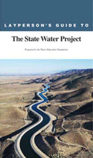
The 24-page Layperson’s Guide to the State Water Project provides
an overview of the California-funded and constructed State Water
Project.
The State Water Project is best known for the 444-mile-long
aqueduct that provides water from the Delta to San Joaquin Valley
agriculture and southern California cities. The guide contains
information about the project’s history and facilities.
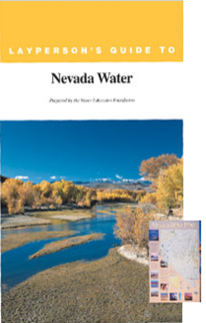
The 28-page Layperson’s Guide to Nevada Water provides an
overview of the history of water development and use in Nevada.
It includes sections on Nevada’s water rights laws, the history
of the Truckee and Carson rivers, water supplies for the Las
Vegas area, groundwater, water quality, environmental issues and
today’s water supply challenges.
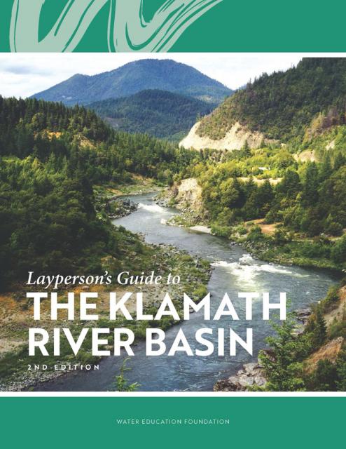
The Water Education Foundation’s second edition of
the Layperson’s Guide to The Klamath River Basin is
hot off the press and available for purchase.
Updated and redesigned, the easy-to-read overview covers the
history of the region’s tribal, agricultural and environmental
relationships with one of the West’s largest rivers — and a
vast watershed that hosts one of the nation’s oldest and
largest reclamation projects.
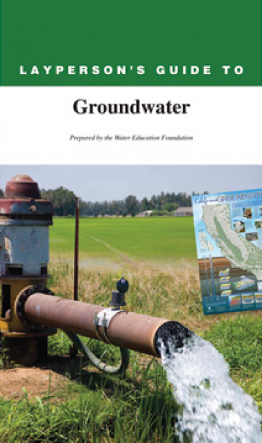
The 28-page Layperson’s Guide to Groundwater is an in-depth,
easy-to-understand publication that provides background and
perspective on groundwater. The guide explains what groundwater
is – not an underground network of rivers and lakes! – and the
history of its use in California.
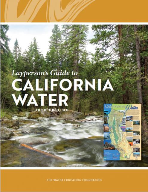
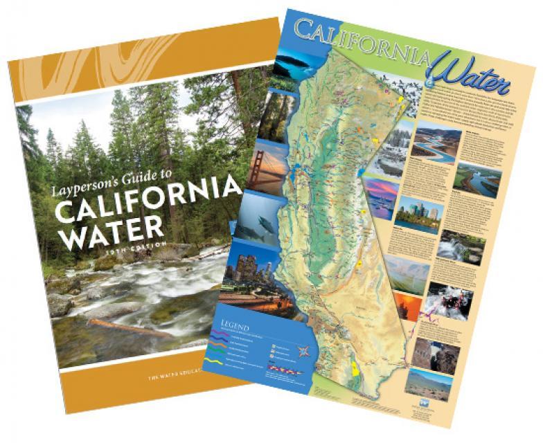
The 24-page Layperson’s Guide to California Water provides an
excellent overview of the history of water development and use in
California. It includes sections on flood management; the state,
federal and Colorado River delivery systems; Delta issues; water
rights; environmental issues; water quality; and options for
stretching the water supply such as water marketing and
conjunctive use. New in this 10th edition of the guide is a
section on the human need for water.
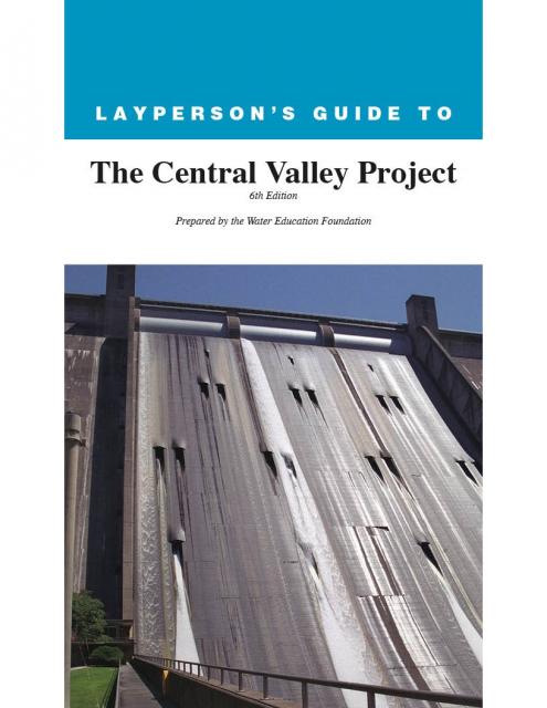
The 24-page Layperson’s Guide to the Central Valley Project
explores the history and development of the federal Central
Valley Project (CVP), California’s largest surface water delivery
system. In addition to the project’s history, the guide describes
the various CVP facilities, CVP operations, the benefits the CVP
brought to the state and the CVP Improvement Act (CVPIA).
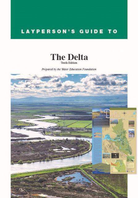
The 24-page Layperson’s Guide to the Delta explores the competing
uses and demands on California’s Sacramento-San Joaquin Delta.
Included in the guide are sections on the history of the Delta,
its role in the state’s water system, and its many complex issues
with sections on water quality, levees, salinity and agricultural
drainage, fish and wildlife, and water distribution.
California’s growth has closely paralleled an evolving and
complex system of water rights.
After California became a state in 1850, it followed the practice
of Eastern states and adopted riparian rights based on
ownership of land bordering a waterway. The riparian
property owner has the right to use that water, a right that
cannot be transferred apart from the land.
Water marketing is the transfer or sale of water or water rights
from one user to another, typically from an agricultural to an
urban water agency, often without investing in new infrastructure
Most exchanges involve a transfer of the resource itself, not a
transfer of the right to use the water.
Reallocating the available water on a supply-and-demand basis is
viewed by proponents as the best financial, political and
environmental means of accommodating an increase in population.
Surface water is water
found in rivers, lakes, streams, and ponds. There are a limited
number of instances in which water in a defined underground
channel is classified as surface water. There are several types
of water rights that apply to surface water.
A landowner whose property borders a river has a right to use
water from that river on his land. This is called riparian
rights.
In addition to riparian
and appropriative
water rights, there are two other types of surface water rights
in California: pueblo rights and federal reserved rights.
Prescriptive Rights are water use rights gained illicitly that
evolve into a title. Typically this occurs with rights to
chronically overdraftedgroundwater basins gained
through trespass or unauthorized use.
In California, the California Supreme Court developed the
doctrine of prescriptive rights in 1949.
Henry J. Vaux Jr. is the professor of resource economics,
emeritus, of the University of California, Berkeley, and the
University of California, Riverside.
Adjudicate -To determine rights by a
lawsuit in court.
Appropriative Right – A right based on physical
control of water and since 1914 in relation to surface water, a state-issued
permit or license for its beneficial use. Appropriative
water rights in California are divided into pre-1914 and
post-1914 rights, depending on whether they were initiated after
the December 19, 1914 effective date of the Water Commission Act
of 1913. Post-1914 rights can only be initiated by filing an
application and obtaining a permit from the state. The program is
now administered by the State Water Resources Control
Board.
Groundwater banking is a process of diverting floodwaters or
other surface water into
an aquifer where it can be
stored until it is needed later. In a twist of fate, the space
made available by emptying some aquifers opened the door for the
banking activities used so extensively today.
When multiple parties withdraw water from the same aquifer,
groundwater pumpers can ask the court to adjudicate, or hear
arguments for and against, to better define the rights that
various entities have to use groundwater resources. This is known
as groundwater adjudication. [See also California
water rights and Groundwater Law.]
Federal reserved rights were created when the United States
reserved land from the public domain for uses such as Indian
reservations, military bases and national parks, forests and
monuments. [See also Pueblo Rights].
This printed issue of Western Water looks at California
groundwater and whether its sustainability can be assured by
local, regional and state management. For more background
information on groundwater please refer to the Foundation’s
Layperson’s Guide to Groundwater.
This issue of Western Water looks at the BDCP and the
Coalition to Support Delta Projects, issues that are aimed at
improving the health and safety of the Delta while solidifying
California’s long-term water supply reliability.
This printed issue of Western Water examines the issues
associated with the State Water Board’s proposed revision of the
water quality Bay-Delta Plan, most notably the question of
whether additional flows are needed for the system, and how they
might be provided.
This printed issue of Western Water examines
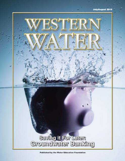
groundwater banking, a water management strategy with appreciable
benefits but not without challenges and controversy.
“Let me state, clearly and finally, the Interior Department is
fully and completely committed to the policy that no water which
is needed in the Sacramento Valley will be sent out of it. There
is no intent on the part of the Bureau of Reclamation ever to
divert from the Sacramento Valley a single acre-foot of water
which might be used in the valley now or later.” – J.A. Krug,
Secretary of the Interior, Oct. 12, 1948, speech at Oroville, CA
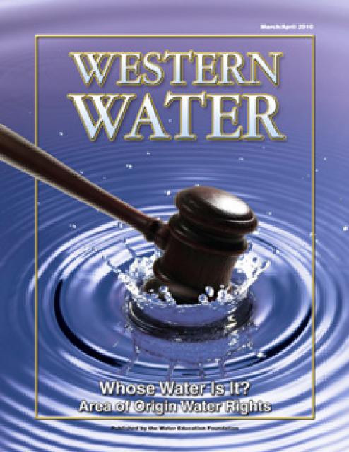
This printed issue of Western Water examines the area
of origin laws, what they mean to those who claim their
protections and the possible implications of the Tehama Colusa
Canal Authority’s lawsuit against the Bureau of Reclamation.
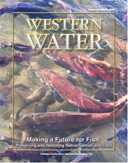
This printed copy of Western Water examines the native salmon and
trout dilemma – the extent of the crisis, its potential impact on
water deliveries and the lengths to which combined efforts can
help restore threatened and endangered species.
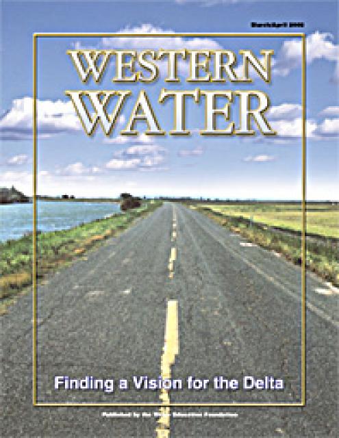
This printed copy of Western Water examines the Delta through the
many ongoing activities focusing on it, most notably the Delta
Vision process. Many hours of testimony, research, legal
proceedings, public hearings and discussion have occurred and
will continue as the state seeks the ultimate solution to the
problems tied to the Delta.
This issue of Western Water examines the challenges facing state,
federal and tribal officials and other stakeholders as they work
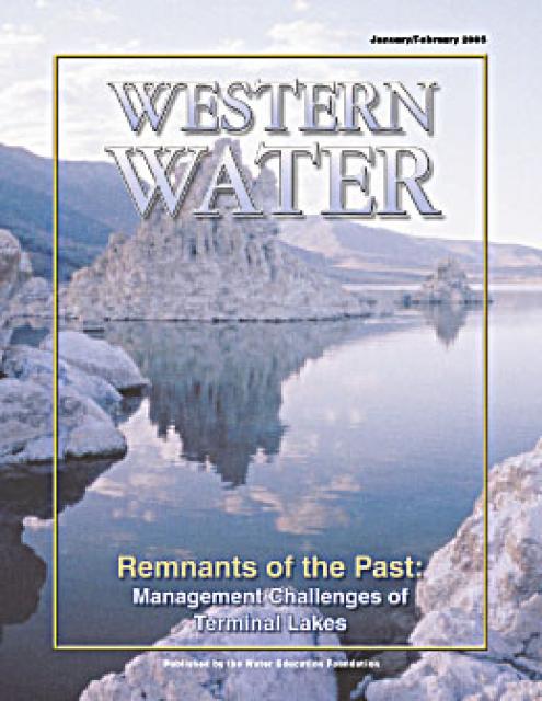
to manage terminal lakes. It includes background information on
the formation of these lakes, and overviews of the water quality,
habitat and political issues surrounding these distinctive bodies
of water. Much of the information in this article originated at
the September 2004 StateManagement Issues at Terminal Water
Bodies/Closed Basins conference.
Priority: the right to precedence over others in obtaining,
buying, or doing something – Webster’s New World College
Dictionary
First in time, first in right has long served as one guiding
principle of water law in California. Simply put, this priority
system generally holds that the first person to claim water and
use it has a right superior to subsequent claims. In times of
shortage, it is the most junior of water rights holders who must
cut back use first.
Drawn from a special stakeholder symposium held in September 1999
in Keystone, Colorado, this issue explores how we got to where we
are today on the Colorado River; an era in which the traditional
water development of the past has given way to a more
collaborative approach that tries to protect the environment
while stretching available water supplies.


 and other tributaries of the upper Colorado River have declined dramatically and contributed to the precipitous declines of Lake Powell and Lake Mead. (Source: The Water Desk)")

")
")
")

")

")
")

")

")