Stretching along the eastern edge of the state, the Sierra Nevada
region incorporates more than 25 percent of California’s land
area and forms one of the world’s most diverse watersheds.
It features granite cliffs, lush forests and alpine meadows on
the westside, and stark desert landscapes at the base of the
eastside. Wildlife includes bighorn sheep, mule deer, black bear
and mountain lions, hawks, eagles, and trout.
The majority of total annual precipitation – in the form of rain
and snow – falls in the Sierra Nevada. Snowmelt from the Sierra
provides water for irrigation for farms that produce half of the
nation’s fruit, nuts and vegetables, and also is a vital source
for dairies, which have made California the largest milk producer
in the country.
In addition, Sierra snowmelt provides drinking water to Sierra
Nevada residents and a portion of drinking water to 23 million
people living in cities stretching from the Bay Area to Southern
California.
Plumas County recently commissioned an independent review of
vested mining rights for the Engels-Superior Mines, situated in
the county. Best Best & Krieger LLP (BBK), a prominent law
firm, undertook this investigation, posting its findings in a
detailed memorandum on April 15, 2024. The memorandum addresses
a request by California-Engels Mining Company (owner) and US
Copper Corp (applicant). This request pertains to the Engels
Mine and Superior Mine located in Indian Valley on the Feather
River watershed. The memorandum, accessible on the Plumas
County Zoning Administrator website, illuminates the historical
context and legal intricacies surrounding the mining
operations. It discusses five determinations sought by the
applicant, including the mining history, vesting date, extent
of mining, continuity of mining rights, and intent to continue
mining.
Four years ago, over 97% of Big Basin Redwoods State Park in
Santa Cruz County burned during the state’s worst wildfire
season in recorded history. Last year, unprecedented winter
storms caused an estimated $190 million in damages to coastal
parks. And at Seacliff State Beach, also in Santa Cruz County,
storms flooded the campground and destroyed the beach’s
historic pier. Climate change and the resulting severe
wildfires, extreme storms and rising sea levels are
increasingly threatening our beloved state parks. … To
address this unprecedented threat, we need to create
climate-resilient state parks that can prepare for, adapt to
and recover from climate impacts. -Written by Rachel Norton, the executive director
of the California State Parks Foundation.
Even though Pacific storms have become less frequent, as is
often the case in April, a new storm is brewing and will slice
across California just in time for the weekend, bringing areas
of rain, mountain snow and much cooler air, AccuWeather
meteorologists say. … A storm over the Gulf of Alaska will
drop southward just off the coast into Friday and will swing
toward California this weekend. … A few inches to
perhaps a foot of snow may fall over the high country of the
Sierra Nevada from the weekend storm.
… This marked the second year in a row with above-average
snowfall and was a huge turnaround from conditions at the
beginning of 2024, when the snowpack across the state was
barely a quarter of the historic average. … The
relationship between snowfall and climate change is not as
simple as it might first appear. Though rising temperatures
will cause some would-be snow to fall as rain, this is partly
balanced out by the fact that precipitation will become more
intense overall, since warmer air can hold more water vapor.
Some parts of Alaska and Northern Canada have
seen increases in snowfall over the last 40 years; in
these frigid locales the amount of snow is more limited by cold
weather, which decreases the amount of moisture in the air. -Written by Ned Kleiner, a scientist and catastrophe
modeler at Verisk.
… So what kind of fire season are we in for this year? Like
2023, this year has been a wet one. … After the wet
winter, vegetation in the state isn’t as parched as it would be
during a drought, so wildfire activity is likely to be pretty
low in the spring and early summer, Daniel Swain, a climate
scientist at the University of California, Los Angeles, said in
an online briefing this week. … But the year probably
won’t stay as quiet as 2023 was. This year’s wet weather hasn’t
been as extreme as last year’s — some inland cities, like
Fresno and South Lake Tahoe, actually received less rain
than usual this year — so plants and soil are more likely
to dry out over the rest of this year than they were last year.
“I would be somewhat surprised if this year was not
significantly more active,” Swain said.
Yesterday, Gov. Gavin Newsom surveyed the Sierra snowpack and
outlined a new state water plan focused on climate change.
Scott and KQED climate reporter Ezra David Romero are joined by
California’s former top water regulator Felicia Marcus. As
the state’s top water czar, she navigated severe droughts,
balancing demands for scare water by cities, farms, businesses
and homeowners.
It was an average year for Colorado’s snowpack — and that’s
great news. The statewide snowpack sat at 109% of the
30-year median on Wednesday, just a few days shy of the normal
peak of snowpack for the state. Every major river basin in the
state also recorded above-median snowpack, reducing the risk of
large, uncontrollable wildfires and boosting the state’s water
supplies. Despite a slow start to the snow season, large
storms in February and March boosted the amount of water that
will become available as mountain snow melts. The statewide
snowpack had lagged behind the median until early March.
California’s water resources look promising thanks to a string
of cold, wet storms since January, but the state’s leaders are
eyeing how significant the payout from those storms will be for
future years. State officials and experts from the University
of California, Berkeley’s Central Sierra Snow Laboratory say
the Golden State’s water and snow outlook is looking good this
spring, despite a dry start to the water year. The milestone
snowpack survey of the year, conducted Tuesday at Phillips
Station in El Dorado County, found a snowpack measuring 64
inches and a snow water equivalent — water contained in the
snowpack — of 27.5 inches. … All state watersheds
have significantly improved in water storage since Feb. 20,
with all sitting at 90% or higher. The State Water Project also
increased its forecast allocation of water supplies to 30%.
As winter conditions wind down, the beginning of April is
always the most important time for California’s water managers
to take stock of how much snow has fallen in the Sierra
Nevada. This year, something unusual happened. After years
of extreme drought and several very wet flood years, the Sierra
snowpack, the source of one-third of the state’s water supply,
is shockingly average this year: 104% of normal on
Friday. And more is on the way.
On Sunday, California’s rainy season officially comes to an
end. … So, how did this wet season stack up? As of Tuesday,
California had received slightly more rain than usual this
winter — 104 percent of the average, according to state data.
The state’s snowpack, which accumulates in the Sierra Nevada
and typically provides 30 percent of the state’s water supply
for the year, is at 101 percent of normal for this time of
year. The state’s reservoirs are at an even higher 116 percent
of their normal levels, in part because they are still
benefiting from the back-to-back “atmospheric rivers” that
slammed California last winter.
The frustration for farmers continues to grow after recent news
of recent water allocation numbers. The Bureau of Reclamation
has announced a 35 percent federal allocation for Central
Valley Project recipients, as the California Department of
Water Resources has allocated 30 percent of State Water Project
requests. The news comes as the snowpack in the Sierra
Nevada sits at or near normal. … Joe Del Bosque of Del
Bosque Farms … says he and other farmers were extremely
disappointed with the recent numbers. He tells me with the
current snowpack, and recent, and potentially incoming storms,
the allocation should have been higher.
A vast burn scar unfolds in drone footage of a landscape seared
by massive wildfires north of Lake Tahoe. But amid the expanses
of torched trees and gray soil, an unburnt island of lush green
emerges. The patch of greenery was painstakingly engineered. A
creek had been dammed, creating ponds that slowed the flow of
water so the surrounding earth had more time to sop it up. A
weblike system of canals helped spread that moisture through
the floodplain. Trees that had been encroaching on the wetlands
were felled. But it wasn’t a team of firefighters or
conservationists who performed this work. It was a crew of
semiaquatic rodents whose wetland-building skills have seen
them gain popularity as a natural way to mitigate
wildfires. A movement is afoot to restore beavers to the
state’s waterways, many of which have suffered from their
absence.
It’s the second straight year of above-average rain and snow in
California, amid the state’s driest period in 1,200 years. The
respite from drought is certainly welcome, despite flooding,
mudslides and associated miseries. Now meteorologists and
oceanographers are watching possible La Niña conditions develop
in the Pacific, perhaps signaling a return to drier times. It’s
an appropriate time to take stock — of how we weathered the
last two winters, what we’ve learned and what’s ahead.
… It’s also important to note that California got a
scary dose of climate change reality early in the winter when
all that precipitation failed to turn into Sierra snowpack. It
does us little good to get lots of rain or even snow if the
weather is too warm to permit snow accumulation on the slopes.
The annual snowpack‘s slow spring-and-summer melt has
historically been the primary source of water for California
cities and farm fields.
Some of California’s most treasured parks are threatened by
blight caused by pollution and climate change, according to a
pair of new reports. The four national parks with the highest
ozone levels are all in California, with Sequoia and Kings
Canyon National Parks topping the list of parks struggling with
air that’s dangerous to breathe, according to a recent report
by the National Parks Conservation Assn., an independent
advocacy group. Meanwhile, severe wildfires, drought and
sea-level rise are ravaging state parks, which encompass nearly
a quarter of California’s coastline, according to a separate
report by the California State Parks Foundation, another
advocacy group. … Behemoth sequoias and jagged Joshua
trees are among millions of trees across the state
succumbing to worsening wildfires, severe drought, extreme
heat, disease and other stressors that have been intensified by
global warming.
All weather patterns must come to an end, and the setup that
allowed warm and dry conditions over much of the Northwest and
limited rainfall in California in recent days will wind down
later this week as a new train of storms lines up over the
northern Pacific, AccuWeather meteorologists
say. The storm train is not as intense as some episodes
over the winter, but with a breakdown of high
pressure over the Northwest and a southward shift in
the jet stream from the Pacific into North America,
there will be more opportunities for rain and mountain snow as
well as locally heavy precipitation that can slow travel on
highways and airports. … While a blockbuster snowfall is
not anticipated in the Sierra Nevada, the change to snow will
be more deliberate and add to the snowpack.
A network of artificial streams is teaching scientists how
California’s mountain waterways — and the ecosystems that
depend on them — may be impacted by a warmer, drier climate.
Over the next century, climate change is projected to bring
less snowfall to the Sierra Nevada. … In a new study,
University of California, Berkeley, researchers used a series
of nine artificial stream channels off Convict Creek in Mammoth
Lakes, California, to mimic the behavior of headwater streams
under present-day conditions and future climate change
scenarios.
In January, the Sierra Nevada snowfall outlook was bleak.
California’s snowpack sat at levels less than half of normal,
and more sand than snow lined the shores of Lake Tahoe. Across
the West, experts voiced concern about snow drought. But, in
California, prospects turned around the following month as a
steady stream of storms added to the snowpack, culminating in
an epic blizzard. Things played out quite differently in other
parts of the country — large swaths of the U.S., including the
Midwest, lack healthy snow levels. … In the future,
snowy winters producing well above-normal snowpack like last
year may still occur, but “those kinds of winters are going to
become less common in a warming world,” said Brian
Brettschneider, a climate scientist at the National Weather
Service Alaska Region.
Growing up in the shadow of the
Rocky Mountains, Andrew Schwartz never missed an opportunity to
play in – or study – a Colorado snowstorm. During major
blizzards, he would traipse out into the icy wind and heavy
drifts of snow pretending to be a scientist researching in
Antarctica.
Decades later, still armed with an obsession for extreme weather,
Schwartz has landed in one of the snowiest places in the West,
leading a research lab whose mission is to give California water
managers instant information on the depth and quality of snow
draping the slopes of the Sierra Nevada.
On average, more than 60 percent of
California’s developed water supply originates in the Sierra
Nevada and the southern spur of the Cascade Range. Our water
supply is largely dependent on the health of our Sierra forests,
which are suffering from ecosystem degradation, drought,
wildfires and widespread tree mortality.
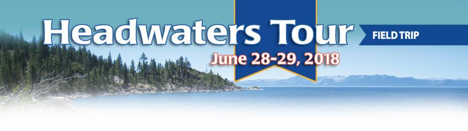
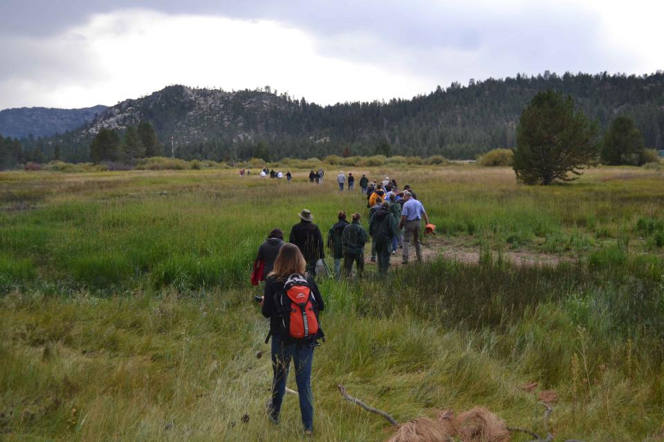
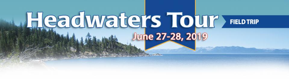
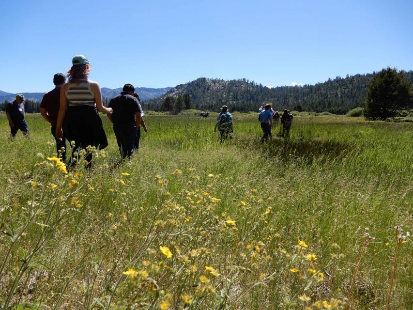
This tour ventured into the Sierra to examine water issues
that happen upstream but have dramatic impacts downstream and
throughout the state.
Innovative efforts to accelerate
restoration of headwater forests and to improve a river for the
benefit of both farmers and fish. Hard-earned lessons for water
agencies from a string of devastating California wildfires.
Efforts to drought-proof a chronically water-short region of
California. And a broad debate surrounding how best to address
persistent challenges facing the Colorado River.
These were among the issues Western Water explored in
2019, and are still worth taking a look at in case you missed
them.
Many of California’s watersheds are
notoriously flashy – swerving from below-average flows to jarring
flood conditions in quick order. The state needs all the water it
can get from storms, but current flood management guidelines are
strict and unyielding, requiring reservoirs to dump water each
winter to make space for flood flows that may not come.
However, new tools and operating methods are emerging that could
lead the way to a redefined system that improves both water
supply and flood protection capabilities.
It’s been a year since two devastating wildfires on opposite ends
of California underscored the harsh new realities facing water
districts and cities serving communities in or adjacent to the
state’s fire-prone wildlands. Fire doesn’t just level homes, it
can contaminate water, scorch watersheds, damage delivery systems
and upend an agency’s finances.
The majestic beauty of the Sierra
Nevada forest is awe-inspiring, but beneath the dazzling blue
sky, there is a problem: A century of fire suppression and
logging practices have left trees too close together. Millions of
trees have died, stricken by drought and beetle infestation.
Combined with a forest floor cluttered with dry brush and debris,
it’s a wildfire waiting to happen.
Fires devastate the Sierra watersheds upon which millions of
Californians depend — scorching the ground, unleashing a
battering ram of debris and turning hillsides into gelatinous,
stream-choking mudflows.
Registration opens today for the
Water Education Foundation’s 36th annual Water
Summit, set for Oct. 30 in Sacramento. This year’s
theme, Water Year 2020: A Year of Reckoning,
reflects fast-approaching deadlines for the State Groundwater
Management Act as well as the pressing need for new approaches to
water management as California and the West weather intensified
flooding, fire and drought. To register for this can’t-miss
event, visit our Water Summit
event page.
Registration includes a full day of discussions by leading
stakeholders and policymakers on key issues, as well as coffee,
materials, gourmet lunch and an outdoor reception by the
Sacramento River that will offer the opportunity to network with
speakers and other attendees. The summit also features a silent
auction to benefit our Water Leaders program featuring
items up for bid such as kayaking trips, hotel stays and lunches
with key people in the water world.
Our 36th annual
Water Summit,
happening Oct. 30 in Sacramento, will feature the theme “Water
Year 2020: A Year of Reckoning,” reflecting upcoming regulatory
deadlines and efforts to improve water management and policy in
the face of natural disasters.
The Summit will feature top policymakers and leading stakeholders
providing the latest information and a variety of viewpoints on
issues affecting water across California and the West.
One of California Gov. Gavin
Newsom’s first actions after taking office was to appoint Wade
Crowfoot as Natural Resources Agency secretary. Then, within
weeks, the governor laid out an ambitious water agenda that
Crowfoot, 45, is now charged with executing.
That agenda includes the governor’s desire for a “fresh approach”
on water, scaling back the conveyance plan in the Sacramento-San
Joaquin Delta and calling for more water recycling, expanded
floodplains in the Central Valley and more groundwater recharge.
There’s going to be a new governor
in California next year – and a host of challenges both old and
new involving the state’s most vital natural resource, water.
So what should be the next governor’s water priorities?
That was one of the questions put to more than 150 participants
during a wrap-up session at the end of the Water Education
Foundation’s Sept. 20 Water Summit in Sacramento.
Sixty percent of California’s developed water supply
originates high in the Sierra Nevada mountains. Our water
supply is largely dependent on the health of our Sierra forests,
which are suffering from ecosystem degradation, drought,
wildfires and widespread tree mortality.
We headed into the foothills and the mountains to examine
water issues that happen upstream but have dramatic impacts
downstream and throughout the state.
GEI (Tour Starting Point)
2868 Prospect Park Dr.
Rancho Cordova, CA 95670.
Water supply for
California’s cities and farms is largely dependent on
snowmelt from the upper watershed in the Sierra Nevada. But that
paradigm is being challenged by wildfires, climate change and
widespread tree mortality.
Join us for a two-day tour as we head into the Sierra foothills
and up into the mountains to examine water issues that happen
upstream, but have dramatic impacts on water supply and quality
downstream and throughout the state.
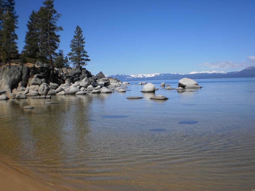
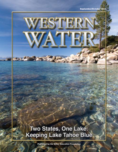
Lake
Tahoe, the iconic high Sierra water body that straddles
California and Nevada, has sat for more than 10,000 years at the
heart of the Washoe tribe’s territory. In fact, the name Tahoe
came from the tribal word dá’aw, meaning lake.
The lake’s English name was the source of debate for about 100
years after it was first “discovered” in 1844 by people of
European descent when Gen. John C. Fremont’s expedition made its
way into the region. Not long after, a man who carried mail on
snowshoes from Placerville to Nevada City named it Lake Bigler in
honor of John Bigler, who served as California’s third governor.
But because Bigler was an ardent secessionist, the federal
Interior Department during the Civil War introduced the name
Tahoe in 1862. Meanwhile, California kept it as Lake Bigler and
didn’t officially recognize the name as Lake Tahoe until 1945.
Sixty percent of California’s developed water supply originates
high in the Sierra Nevada.Thus, the state’s water supply is
largely dependent on the health of Sierra forests, which are
suffering from ecosystem degradation, drought, wildfires and
widespread tree mortality.
Join us as we head into the Sierra foothills and up to the
mountains to examine water issues that happen upstream but have
dramatic impacts downstream and throughout California.
California voters may experience a sense of déjà vu this year when they are asked twice in the same year to consider water bonds — one in June, the other headed to the November ballot.
Both tackle a variety of water issues, from helping disadvantaged communities get clean drinking water to making flood management improvements. But they avoid more controversial proposals, such as new surface storage, and they propose to do some very different things to appeal to different constituencies.
Every day, people flock to Daniel
Swain’s social media platforms to find out the latest news and
insight about California’s notoriously unpredictable weather.
Swain, a climate scientist at the Institute of the
Environment and Sustainability at UCLA, famously coined the
term “Ridiculously Resilient Ridge” in December 2013 to describe
the large, formidable high-pressure mass that was parked over the
West Coast during winter and diverted storms away from
California, intensifying the drought.
Swain’s research focuses on atmospheric processes that cause
droughts and floods, along with the changing character of extreme
weather events in a warming world. A lifelong Californian and
alumnus of University of California, Davis, and Stanford
University, Swain is best known for the widely read Weather West blog, which provides
unique perspectives on weather and climate in California and the
western United States. In a recent interview with Western
Water, he talked about the Ridiculously Resilient Ridge, its
potential long-term impact on California weather, and what may
lie ahead for the state’s water supply.
Sixty percent of California’s developed water supply
originates high in the Sierra Nevada mountains. Our water
supply is largely dependent on the health of our Sierra forests,
which are suffering from ecosystem degradation, drought,
wildfires and widespread tree mortality.
Sixty percent of California’s developed water supply originates
high in the Sierra Nevada. Thus, the state’s water supply is
largely dependent on the health of Sierra forests, which are
suffering from ecosystem degradation, drought, wildfires and
widespread tree mortality.
Join us as we head into the Sierra foothills and the mountains to
examine water issues that happen upstream but have dramatic
impacts downstream and throughout California.
ARkStorm stands for an atmospheric
river (“AR”) that carries precipitation levels expected to occur
once every 1,000 years (“k”). The concept was presented in a 2011
report by the U.S. Geological Survey (USGS) intended to elevate
the visibility of the very real threats to human life, property
and ecosystems posed by extreme storms on the West Coast.
Owens Lake is a dry lake at the terminus of the Owens River
just west of Death Valley and on the eastern side of the Sierra Nevada. For at least
800,000 years, the lake had a continuous flow of water, until
1913 when the Los Angeles Department of Water and Power
(LADWP) completed the 233-mile Los Angeles
Aqueduct to supplement the budding metropolis’
increasing water demands.
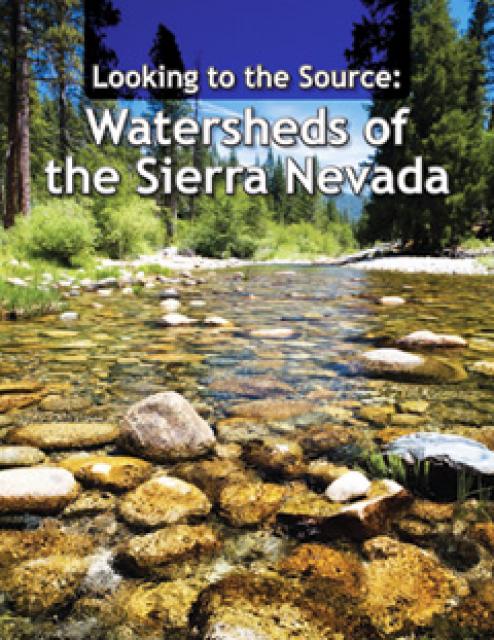
This 28-page report describes the watersheds of the Sierra Nevada
region and details their importance to California’s overall water
picture. It describes the region’s issues and challenges,
including healthy forests, catastrophic fire, recreational
impacts, climate change, development and land use.
The report also discusses the importance of protecting and
restoring watersheds in order to retain water quality and enhance
quantity. Examples and case studies are included.
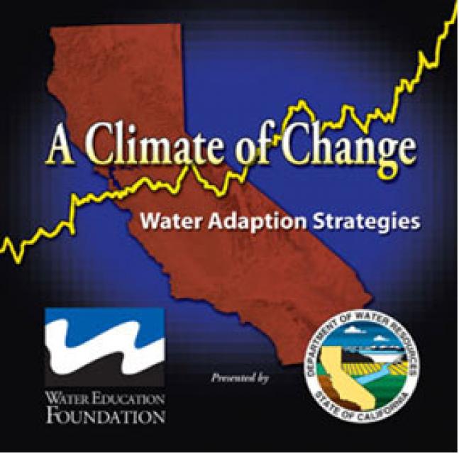
This 25-minute documentary-style DVD, developed in partnership
with the California Department of Water Resources, provides an
excellent overview of climate change and how it is already
affecting California. The DVD also explains what scientists
anticipate in the future related to sea level rise and
precipitation/runoff changes and explores the efforts that are
underway to plan and adapt to climate.
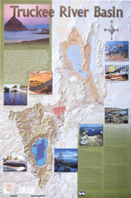
This beautiful 24×36 inch poster, suitable for framing, displays
the rivers, lakes and reservoirs, irrigated farmland, urban areas
and Indian reservations within the Truckee River Basin, including
the Newlands Project, Pyramid Lake and Lake Tahoe. Map text
explains the issues surrounding the use of the Truckee-Carson
rivers, Lake Tahoe water quality improvement efforts, fishery
restoration and the effort to reach compromise solutions to many
of these issues.
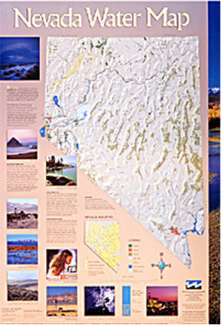
This 24×36 inch poster, suitable for framing, illustrates the
water resources available for Nevada cities, agriculture and the
environment. It features natural and manmade water resources
throughout the state, including the Truckee and Carson rivers,
Lake Tahoe, Pyramid Lake and the course of the Colorado River
that forms the state’s eastern boundary.
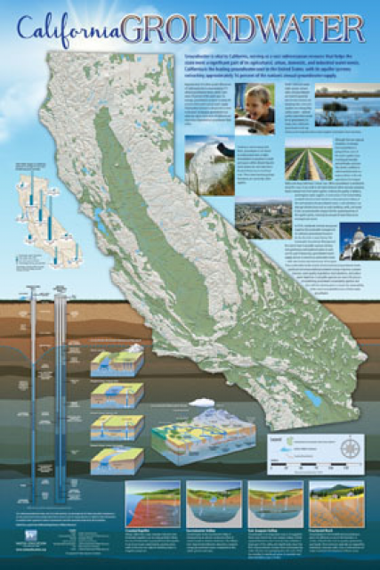
Fashioned after the popular California Water Map, this 24×36 inch
poster was extensively re-designed in 2017 to better illustrate
the value and use of groundwater in California, the main types of
aquifers, and the connection between groundwater and surface
water.
A new look for our most popular product! And it’s the perfect
gift for the water wonk in your life.
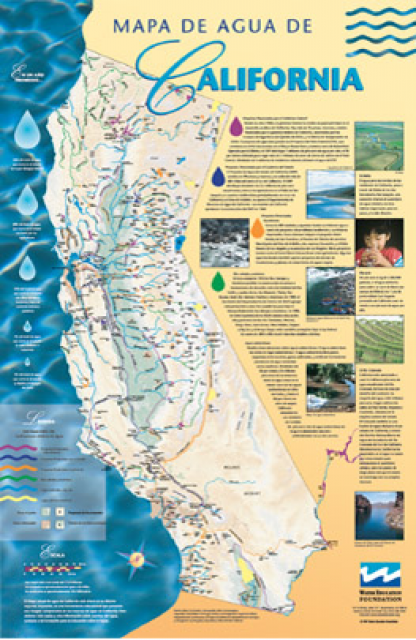
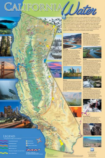
Our 24×36 inch California Water Map is widely known for being the
definitive poster that shows the integral role water plays in the
state. On this updated version, it is easier to see California’s
natural waterways and man-made reservoirs and aqueducts
– including federally, state and locally funded
projects – the wild and scenic rivers system, and
natural lakes. The map features beautiful photos of
California’s natural environment, rivers, water projects,
wildlife, and urban and agricultural uses and the
text focuses on key issues: water supply, water use, water
projects, the Delta, wild and scenic rivers and the Colorado
River.
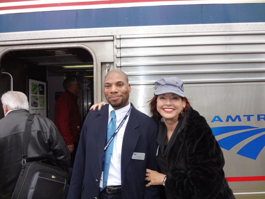
Travel across the state on Amtrak’s famed California
Zephyr, from the edge of sparkling San Francisco Bay,
through the meandering channels of the Delta, past rich Central
Valley farmland, growing cities, historic mining areas and into
the Sierra Nevada mountain range.
Stretching 450 miles long and up to
50 miles wide, the Sierra Nevada makes up more than a quarter of
California’s land area and forms its largest watersheds,
providing more than half of the state’s developed water supply to
residents, agriculture and other businesses.*
The East Fork begins in the mountains of California’s Sonora Pass
and after flowing through California and Nevada, it meets the
West Fork just south of Carson City. The West Fork forms at
California’s Carson Pass, running through California and into
Nevada to its junction with the East Fork.


")

")
")
")
")


")
")