Devastating floods are almost annual
occurrences in the West and in California. With the anticipated
sea level rise and other impacts of a changing climate,
particularly heavy winter rains, flood management is increasingly
critical in California. Compounding the issue are human-made
flood hazards such as levee stability and stormwater runoff.
California’s changing climate brings new challenges each year
for water managers as they navigate extreme shifts from drought
to flood while working to ensure safe, reliable water supplies
for California’s 39 million residents. Water managers address
these challenges in their local watersheds, which are often at
the forefront of the impacts of climate change.
From Sequoia Park to the old Tulare Lake bed, local authorities
recount the same story. A deluge of biblical proportions,
including heavy rain and storm runoff, in the past year in the
Kaweah, Kings and Tule basins has caused hundreds of millions
of dollars in damage to the region’s road and bridge
infrastructure. … Still a year later, government
agencies continue to struggle to repair the extensive damage
requiring federal funding to make it happen.
In a place as dry as the desert city of Dubai, whenever they
can get rain, they’ll take it. United Arab Emirates authorities
will often even try to make it rain—as they did earlier this
week when the National Center of Meteorology dispatched planes
to inject chemicals into the clouds to try to coax some
showering. But this time they got much more than they
wanted. Dubai faced torrential downpours on Tuesday, with
flooding shutting down much of the city … The UAE government
media office said it was the heaviest rainfall recorded in 75
years and called it “an exceptional event.” More than a typical
year’s worth of water was dumped on the country in a single
day. Now, many people are pointing a finger at the “cloud
seeding” operations preceding the precipitation.
Record-breaking heat waves, severe floods and acute wildfires,
exacerbated by climate change, carry a colossal price tag: an
approximately 19% reduction in global income over just the next
26 years, a new study published Wednesday found. That financial
gut punch won’t just affect big governments and corporations.
According to the United Nations, the world is heading toward a
gain of nearly 3 degrees of global warming in the next century,
even with current climate policies and goals – and researchers
say individuals could bear the economic burden. The researchers
in Wednesday’s study, published in Nature, said financial pain
in the short-term is inevitable, even if governments ramp up
their efforts to tackle the crisis now.
San Francisco has been giving Seattle a run for its money on
the precipitation front. Since Jan. 1, nearly 18 inches of
rain has accumulated in San Francisco. Meanwhile, Seattle sits
at just 13 inches. This year is unusual. San Francisco
has been rainier than Seattle in just 16 of the past 50 years
through mid-April. In a normal year, San Francisco trails
Seattle by about 2.5 inches of precipitation on April
14. Annually, Seattle averages 16.5 inches more rainfall
than San Francisco and may still surpass San Francisco this
year. While 2024’s rainfall may seem topsy-turvy, it
fits expectations with El Niño, a global climate pattern that
has its biggest influence on West Coast storms from January
through April.
California’s Death Valley, the driest place in North America,
has hosted an ephemeral lake since late 2023. A NASA-led
analysis recently calculated water depths in the temporary lake
over several weeks in February and March 2024, demonstrating
the capabilities of the U.S.-French Surface Water and Ocean
Topography (SWOT) satellite, which launched in December 2022.
The analysis found that water depths in the lake ranged from
about 3 feet (1 meter) to less than 1.5 feet (0.5 meters) over
the course of about 6 weeks. This period included a series of
storms that swept across California, bringing record amounts of
rainfall.
President Biden has approved California’s request for a major
disaster declaration to support recovery efforts from a string
of February storms that drenched much of the state with
historic rainfall and mountain snow and resulted in numerous
deaths, officials announced Sunday. Nine California counties —
Butte, Glenn, Los Angeles, Monterey, San Luis Obispo, Santa
Barbara, Santa Cruz, Sutter and Ventura — will receive federal
aid as a result of the declaration, which also includes funding
for statewide hazard mitigation efforts, officials said. “
Erica Gies has always cared deeply about water. … Today, Gies
is an award-winning independent journalist and author who has
covered sustainability and water in outlets like The New York
Times, Scientific American, Nature, The Economist, and National
Geographic … River Partners sat down with Gies recently to
talk about bringing back floodplains, the importance of native
seeds and plants in restoration, what California is doing—and
what it could be doing—in managing water, and how optimistic
she is that we can thrive in an era of weather whiplash.
A northern Arizona county is getting $15.5 million in federal
funding to mitigate post-wildfire flood damage, the Biden
administration announced Thursday. Coconino County received the
funding to make improvements to the drainage system along U.S.
Highway 89. Wildfires have made the area more susceptible to
flooding that threatens homes and businesses and forces highway
closures. The Navajo Nation and Hopi Reservation are
disproportionately impacted by the flood threat, according to
the U.S. Department of Transportation.
Earth’s worrisome warming trajectory continued unabated last
month, with March marking the 10th month in a row that the
planet has broken global heat records, international climate
officials announced this week. With an average surface
temperature of 57.45 degrees Fahrenheit, last month was warmer
globally than any previous March on record, according to the
European Union’s Copernicus Climate Change Service.
… There is a 62% chance that its cooler, drier
counterpart, La Niña, will develop between June and August.
That could be good news for temperatures but bad news for water
supplies — at least in Southern California.
The water in California’s San Francisco Bay could rise more
than two meters by the year 2100. For the region’s tidal
marshes and their inhabitants, such as the endangered Ridgway’s
rail and the salt marsh harvest mouse, it’s a potential death
sentence. Given enough time, space, and sediment, tidal marshes
can build layers of mud and decaying vegetation to keep up with
rising seas. Unfortunately, upstream dams and a long history of
dredging bays and dumping the sediment offshore are starving
many tidal marshes around the world of the sediment they need
to grow. To keep its marshes above water, San Francisco Bay
needs more than 545 million tonnes of dirt by 2100.
Wetlands have flourished along the world’s coastlines for
thousands of years, playing valuable roles in the lives of
people and wildlife. They protect the land from storm surge,
stop seawater from contaminating drinking water supplies, and
create habitat for birds, fish and threatened species. Much of
that may be gone in a matter of decades. As the planet warms,
sea level rises at an ever-faster rate. Wetlands have generally
kept pace by building upward and creeping inland a few meters
per year. But raised roadbeds, cities, farms and increasing
land elevation can leave wetlands with nowhere to go. Sea-level
rise projections for midcentury suggest the waterline will be
shifting 15 to 100 times faster than wetland migration has been
clocked. -Written by Randall W. Parkinson, Research Associate
Professor in Coastal Geology, Florida International
University.
… [C]occidioides, a fungus that causes a disease called
coccidioidomycosis, better known as valley fever. If inhaled,
microscopic spores from the fungus can lodge in the lungs.
About a third of those infected with cocci never have any
symptoms, and most of those infected clear the disease and
develop immunity. But for between 1 and 5% of those who inhale
it, cocci spreads through the bloodstream and wreaks havoc in
the body that can sometimes be lethal. And the changing climate
has allowed valley fever to spread far beyond its traditional
territory of Arizona and parts of Southern California.
A first-of-its-kind report has estimated that Los Angeles
County must invest billions of dollars through 2040 to protect
residents from worsening climate hazards, including extreme
heat, increasing precipitation, worsening wildfires, rising sea
levels and climate-induced public health threats. The report,
published this week by the nonprofit Center for Climate
Integrity, identified 14 different climate adaptation measures
that authors calculated would cost L.A. taxpayers at least
$12.5 billion over the next 15 years. … To mitigate
these impacts, the county must expand its stormwater drainage
infrastructure by installing bioswales, porous pavement and
other opportunities for stormwater to seep into the ground, the
report found.
Almost half of all homes in the U.S. are at severe or extreme
risk of flood, hurricane winds, wildfires, heat and/or
hazardous air quality. In the 2024 Housing and Climate Risk
Report, Realtor.com looked at homes across the nation to
analyze which cities had homes at the highest risk of those
disasters, which the site calls climate
risk. … About 9% of homes across the U.S. are at
severe to extreme air quality risk. The San Francisco
Bay Area tops the list. California’s
frequent droughts, wildfires and heat waves are largely at
fault. ”Shifts in environmental conditions, including
extreme heat, drought, and wildfires, are amplifying the
likelihood of heightened air pollution risk,” wrote
analysts.
With California snowpack and reservoirs at above-average levels
following two wet winters, Gov. Gavin Newsom stood on a snowy
field near Lake Tahoe on Tuesday and urged the state to do much
more to make its water supplies resilient to the extreme
droughts and flooding that come with climate change. … The
governor presented a new water plan that lays out priorities
for changing how the state captures, stores and moves water,
including efforts to replenish groundwater, recycle wastewater
and restore the natural ecosystems of watersheds. Newsom said
his administration is focusing on infrastructure projects such
as building the Sites Reservoir — the first new major reservoir
in decades — and he vowed to move ahead with the proposed Delta
Conveyance Project.
… In a matter of weeks, a succession of powerful storms
flipped the script, dumping a stream of record-setting, intense
rainfall across California, much of it on the state’s
southwestern region. That wet pattern has continued as winter
has given way to spring, with this past weekend’s storm dumping
up to 4 inches of rain in some areas — pushing Los Angeles to a
new two-year rain total not seen since the late 1800s and
forestalling any hope for a quick end to the rainy season.
… With more than 30 million acre-feet of water in
storage, the state’s reservoirs are at 116% of their
historical average.
As a homeowner, you invest a great deal of time, money, love,
imagination, and hard work into your house and property.
Of course, you hope nothing will go seriously wrong. Still, you
purchase homeowner’s insurance to give you peace of mind and to
ensure you’re financially protected if your home and belongings
are damaged by unpredictable events such as fire, vandalism,
theft, or storms. Today, climate change is causing
increasingly erratic weather patterns. Natural disasters,
including severe storms and wildfires, are becoming more
frequent and devastating. In 2023, nine “atmospheric
rivers” pummeled the western United States, dumping record
amounts of rain and snow. According to the National
Environmental Satellite, Data, and Information Service, more
than 32 trillion gallons of water drenched California, racking
up $4.6 billion in damages. -Written by John Petrov, a contractor and public
insurance adjuster with over 25 years of experience in the
construction industry.
On Sunday, California’s rainy season officially comes to an
end. … So, how did this wet season stack up? As of Tuesday,
California had received slightly more rain than usual this
winter — 104 percent of the average, according to state data.
The state’s snowpack, which accumulates in the Sierra Nevada
and typically provides 30 percent of the state’s water supply
for the year, is at 101 percent of normal for this time of
year. The state’s reservoirs are at an even higher 116 percent
of their normal levels, in part because they are still
benefiting from the back-to-back “atmospheric rivers” that
slammed California last winter.
Flooding could affect one out of every 50 residents in 24
coastal cities in the United States by the year 2050, a study
led by Virginia Tech researchers suggests. The study, published
this month in Nature, shows how the combination of land
subsidence—in this case, the sinking of shoreline terrain—and
rising sea levels can lead to the flooding of coastal areas
sooner than previously anticipated by research that had focused
primarily on sea level rise scenarios. … The study
combines measurements of land subsidence obtained from
satellites with sea level rise projections and tide charts,
offering a more holistic projection of potential flooding risks
in 32 cities located along the Atlantic, Pacific and Gulf
coasts.
National Weather Service (NWS) meteorologists shared a map on
social media that reveals which Southern California cities
will be hit hardest by an approaching storm expected to arrive
this weekend. California has faced an abnormally wet winter as
moisture-laden storms and atmospheric rivers dumped a deluge of
rain and snow on the state, beginning in January. The excessive
rainfall has resulted from a slew of atmospheric rivers that
have battered the state this month. Last year, more than a
dozen of them helped alleviate the state’s severe drought
situation and replenished many of the state’s reservoirs, but
the storms also caused devastating floods and landslides.
Real estate websites are sharing more climate risk information
with home buyers and sellers. Why it matters: Of roughly 4,600
prospective buyers Zillow surveyed nationwide last spring, over
80% said they considered at least one climate risk when
shopping. State of play: Realtor.com, which was the first major
site to show a home’s flood risk, added heat, wind and
air-quality risks to listings this month. The company added
wildfire risk in 2022. Threat level: Nearly 45% of U.S. homes
face severe or extreme damage from environmental threats,
according to a new report from Realtor.com.
Spring is here, but the rainy season is clearly not
over in California. Two separate storms are poised to impact
the Golden State this week. The first one is predicted to
impact only Northern California on Wednesday, bringing light
rain. The second one is expected to sweep the
entire state over the weekend, likely delivering a shot of
moderate rain to Northern California and a more substantial
heavy soaking to Southern California. The National Weather
Service’s Los Angeles office is starting to sound the alarm
bells and called the system a “late season
significant storm” in its forecast.
Reclamation today announced a $5.5 million investment from
President Biden’s Bipartisan Infrastructure Law to repair the
Willow Creek Dam in Montana and the B.F. Sisk Dam in California
as part of the Investing in America agenda. Willow Creek Dam in
Montana will use $2.1 million to fund temporary spillway
improvements by installing rock in the spillway to reduce risk
of spillway erosion until a permanent dam safety modification
is completed. Construction will include purchase and placement
of 9,100 cubic yards of rock. Reclamation will reserve another
900 cubic yards on site for flood fighting activities.
Reclamation’s project stakeholder, Greenfields Irrigation
District, will perform the work. B.F. Sisk Dam in California
will use $3.4 million to modify the Phase 1 contract, to adapt
to delays caused by high precipitation levels in 2023.
… Meanwhile, forecasters were looking ahead to a rare
late-season “high-impact” storm that could reach the area by
Friday, according to Robbie Munroe, a meteorologist with the
NWS in Oxnard. Sunday’s bout of stormy weather was driven
by a cold system moving south across the Southland, Munroe
said. “Early projections place us maybe around an inch to
3 inches for a lot of areas — maybe even locally higher for our
south-facing mountains,” he said.
For a time last year, it was difficult to drive through a large
swath of central California without running into the new
shoreline of a long dormant lake. Resurrected for the
first time in decades by an epic deluge of winter rain and
snow, by spring the lake covered more than 100,000 acres,
stretching over cotton, tomato and pistachio fields and miles
of roads. Tulare Lake, or Pa’ashi as it is known to the Tachi
Yokut Tribe, was back. … Scientists and officials predicted
the lake could remain for years to come, sparking consternation
among the local farmers whose land was now underwater, and
excitement from others who saw the lake as a fertile nature
sanctuary and sacred site. … Despite the predictions, the
lake is nearly gone.
… Riparian forest is a rare sight in the Central Valley.
About one million acres of trees, shrubs, and grasses once
flourished, drowned, and flourished again along the valley’s
rivers, creeks, and floodplains; now, perhaps 130,000 acres
remain. In recent years, though, that number has begun to inch
up again. Caswell has about 260 acres. Seven miles south of
there is Dos Rios Ranch—2,100 acres, much of it former dairy
farm and almond orchard, at the extremely floodable confluence
of the Tuolumne and San Joaquin rivers—which is steadily being
restored to riparian forest. Later this year it will open as
California’s first new state park in 15 years.
Years after a massive spill at a Los Angeles water treatment
facility dumped millions of gallons of raw sewage into the
Pacific, officials with the U.S. Environmental Protection
Agency have ordered several improvements at the plant to help
prevent another such disaster, even when facing more intense
storms from a changing climate. The administrative order of
consent, issued this month, requires the Hyperion Water
Reclamation Plant in Playa del Rey to make significant fixes to
its operations and infrastructure, including improving
monitoring systems and overflow channels, after the federal
agency’s review of the 2021 spill. The agreement, between the
EPA and the Los Angeles Sanitation and Environment division,
mandates the updates be implemented by the end of 2025, though
some are required to be completed as soon as within 30 days,
according to the order.
… While the winter season may be drawing to a close, it looks
like California and the broader West will see at least one more
7-10+ day period of winter-like conditions beginning this
weekend. A series of 3-5 weak to moderate storms will affect
California in the next 10-14 days, bringing widespread
precipitation (especially NorCal) and cooler temperatures.
These appear to be fairly decent snow-accumulating storms for
the Sierra–no epic blizzards, but the highest elevations could
accumulate several additional feet over 10+ days and there will
likely be at least some accumulation to much lower elevations
at times. Widespread light to moderate rainfall is likely
throughout northern CA at lower elevations, and locally into
SoCal as well.
Nature is not what comes to mind when an outsider drives
into Bel Marin Keys, a tiny community that begins 1½ miles
east of Highway 101 in Marin County, reached by a single road
that passes a shopping center and small industrial buildings
along the way. The wide streets are monotonous, often lined
with homes that resemble those of countless 1960s subdivisions.
On some blocks, the only hint that creeks and wetlands might be
nearby are the red-winged blackbirds that touch down on utility
poles. … It’s a bucolic scene — and an engineering
landscape that wouldn’t exist if not for the intrusions into
former bay wetlands that now are at risk due to sea level
rise. That’s why residents of Bel Marin Keys voted to
approve a $30 million parcel tax this month aimed at building
stronger and taller levees, plus an improved set of locks to
keep adjacent waters from spilling into one of the lagoons that
give this precarious collection of 700 homes its character.
The United States suffers the world’s second-highest toll from
major weather disasters, according to a new analysis — even
when numbers are adjusted for the country’s wealth. The report
released late last month by Zurich-based reinsurance giant
Swiss Re, which analyzed the vulnerability and damages of 36
different countries, suggests that weather disasters may become
a heavy drag on the U.S. economy — especially as insurers
increasingly pull out of hazardous areas. Those disasters are
driving up insurance rates, compounding inflation and adding to
Americans’ high cost of living. … Some insurers have
stopped offering home insurance policies in California, which
has seen numerous large wildfires in the past few years.
Following a lawsuit filed by hundreds of Pajaro Valley
residents and business owners, farmers and agricultural
landowners and tenants have filed two lawsuits against local,
regional and state agencies they claim are liable for damages
connected to the 2023 Pajaro levee breach and subsequent
flooding. One suit is filed by about a dozen business entities
(and roughly 50 people who are trustees); another by Willoughby
Farms. Each case, filed on March 4 in Monterey County Superior
Court, names a long list of defendants: the counties of
Monterey and Santa Cruz; the Monterey County Water Resources
Agency; Santa Cruz County Flood Control and Water Conservation
District; Pajaro Regional Flood Management Agency; State of
California; and Caltrans. (The Willoughby Farms suit also names
the City of Watsonville and others.)
The Biden administration will be allocating more than $120
million to tribal governments to fight the impacts of climate
change, the Department of the Interior announced Thursday. The
funding is designed to help tribal nations adapt to climate
threats, including relocating infrastructure. Indigenous
peoples in the U.S. are among the communities most affected by
severe climate-related environmental threats, which have
already negatively impacted water resources, ecosystems and
traditional food sources in Native communities in every corner
of the U.S. “As these communities face the increasing
threat of rising seas, coastal erosion, storm surges, raging
wildfires and devastation from other extreme weather events,
our focus must be on bolstering climate resilience …”
Interior Secretary Deb Haaland, a member of the Pueblo of
Laguna, said in a Wednesday press briefing.
… For millennia seasonal wetlands dotted California’s Central
Valley … But as farms and towns have taken over the
landscape, nearly all those shallow, ephemeral water bodies
have disappeared, leaving avian migrants with scant options for
pit stops. With shorebirds rapidly declining along the Pacific
Flyway, conservationists and landowners have joined forces to
help turn the tide. Launched in
2014, BirdReturns runs via reverse auctions … Since
its inception, the program—jointly run by Audubon California,
The Nature Conservancy, and Point Blue Conservation Science—has
paid more than 100 farmers a total of $2 million to flood
60,000 acres throughout the Sacramento and San Joaquin valleys.
Buoyed by a recent $15 million grant from the state, the
program is poised to greatly expand its reach.
The European Commission said on Wednesday it was taking Greece
to the EU’s top court for failing to revise its flood risk
management plans, a key tool for EU countries to prepare
themselves against floods. The action comes five months
after the worst rains in Greece flooded its fertile
Thessaly plain, devastating crops and livestock and raising
questions about the Mediterranean country’s ability to deal
with an increasingly erratic climate. Under EU rules,
countries need to update once in six years their flood
management plans, a set of measures aimed to help them mitigate
the risks of floods on human lives, the environment and
economic activities. Greece was formally notified by the
Commission last year that it should finalise its management
plans but the country has so far failed to review, adopt or
report its flood risk management plans, the Commission said in
a statement.
A new study by Cal State Fullerton researchers shows evidence
of two epic floods that occurred within the past 500 years in
Southern California during the Little Ice Age. Their
research is the first-ever, land-based, flood-event evidence
from 1450 to 1850 — a documented period of above-average
wetness in Southern California, said Matthew E. Kirby,
professor of geological sciences. According to scientists,
floods — not earthquakes — represent California’s single most
significant socioeconomic natural hazard risk.
… Climate models predict that the frequency of
large flood-producing precipitation events will increase in the
21st century due to climate change.
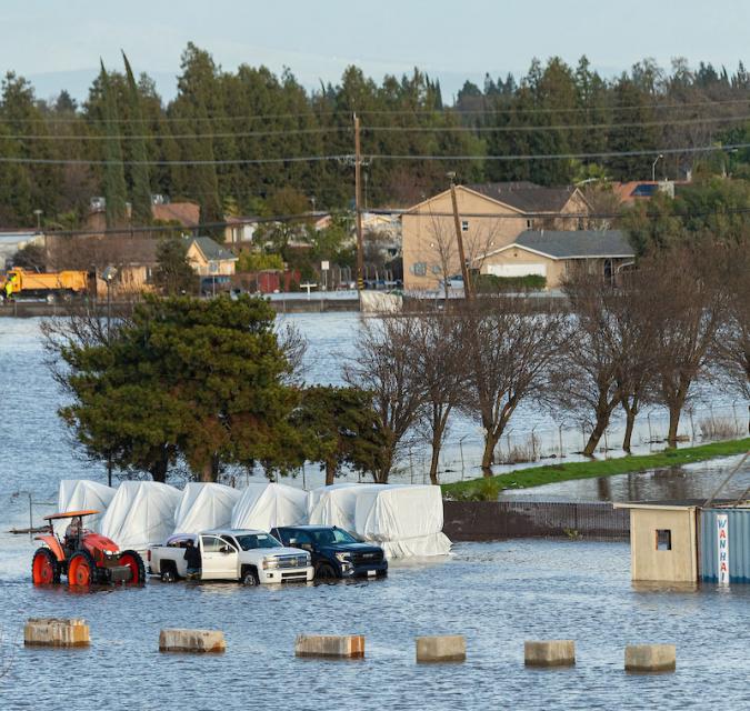
As floodwaters receded from the streets of southeastern San
Diego on Jan. 22, two things began to happen. Several local
nonprofits — not trained in disaster response — set up a victim
assistance center at the Jackie Robinson Family YMCA. At the
same time, county and city officials had a series of extreme
miscommunications that delayed the opening of a government-run
assistance center within city limits for nearly two weeks,
according to letters obtained by Voice of San Diego.
Normally in the wake of a disaster, government officials open
what they call a Local Assistance Center near the disaster
site. These assistance centers connect survivors with
government and non-government resources. A survivor could get
anything from a new driver’s license to food or unemployment
benefits.
Just south of Dos Rios Ranch, a much-praised effort at river
restoration, another such project is taking root. It will add
about 380 acres of floodplain and other habitat to the 1,600
acres at Dos Rios. They are near the confluence of the Tuolumne
and San Joaquin rivers, about eight miles southwest of Modesto.
The state-funded project, totaling about $20.8 million, is on
the former Hidden Valley Dairy. Annual feed crops are giving
way to oaks, cottonwoods, willows and other native plants. The
floodplain will take on high river flows that otherwise could
threaten nearby Grayson and downstream towns. The standing
water could recharge the aquifer below for use during droughts.
The place could offer food and shelter to fish, birds, mammals
and other creatures.
A powerful winter storm buried the Sierra last weekend, with
wet weather continuing for days in the Bay Area and Central
Coast. Thunderstorms Wednesday drenched Salinas, dropping
an entire inch in just 25 minutes. After historic weather last
year, intense California storms have persisted this winter,
with strong downpours causing widespread flooding in San Diego
and damaging landslides in places like Los Angeles. Many
ingredients contribute to extreme storm activity, but
scientists agree that climate change is already amping up
winter rains — and may bring even wilder weather in the
future.
A search continues for a woman last seen being carried
downriver in the Angeles National Forest, California sheriff’s
officials said. The 59-year-old woman lost her footing while
crossing a river near the Heaton Flats Trail at 9:51 a.m.
Saturday, March 9, the Los Angeles County Sheriff’s Office said
in a news release. Strong river currents swept her downstream,
deputies said. She had been hiking with friends. … Some
teams have been airlifted to search areas because of the rugged
terrain and swift river currents, deputies said. The sheriff’s
office encouraged hikers to use “extreme caution” when crossing
rivers.
California has set ambitious climate goals, including phasing
out the use of fossil fuels and becoming carbon neutral by
2045. Our guest today is here to talk about the role nature can
play in meeting those goals. Laurie Wayburn is the co-founder
and president of the Pacific Forest Trust and the chair of the
California Natural and Working Lands Expert Advisory Committee.
She was also the lead author of a recent report suggesting the
state should invest “as much in nature-based climate solutions
as it has in clean energy and transportation.” With proper
forest management, California could capture 400 million tons of
carbon each year, lower wildfire risk and vastly improve flood
protection in the state.
A report released by the Navy confirmed concerns that for years
have been hanging over the radiological cleanup of San
Francisco’s Hunters Point Shipyard: that rising seawater
levels, and other environmental factors resulting from climate
change, could cause toxic materials that have long been buried
at the site to surface. The study, called Climate
Resilience Assessment, was included in an ongoing review
process that the Navy must undertake every five years to
evaluate its remediation plan for the former shipyard, which
has long been a designated Superfund site. The shipyard is
also slated for redevelopment into a new neighborhood, with
cleaning efforts by the Navy and its contractors underway for
more than a decade to prepare it for reuse. The report is
the first time that the Navy has studied the impacts of climate
change in relation to the shipyard, which spans hundreds of
acres and contains radioactive waste and other contaminants.
Almost three months after a January storm and flash floods
killed several people and displaced hundreds of San Diego-area
residents, the state is offering one-time
Disaster CalFresh benefits to help families
recover. To be eligible for disaster food benefits, people
must have lived or worked in storm-impacted areas on Jan. 21,
the day record rainfall swelled creeks and rivers, deluging
neighborhoods. About 600 people sought emergency shelter.
California’s Department of Social Services said it will provide
30 days of food benefits to families who qualify.
Anew time-lapse video shared on social media shows Tulare Lake,
California’s ghost lake, disappear after re-forming last year.
A series of atmospheric rivers hit California last year during
an abnormally wet winter season and caused the lake to reemerge
in the San Joaquin Valley. The original lake was once much
larger than Lake Tahoe and was known to be the largest
freshwater lake in the West, but it began to dry up in the late
1800s and fully disappeared 80 years ago when water was
diverted and the land was repurposed for agricultural
uses. Atmospheric rivers are a “long, narrow region in the
atmosphere—like rivers in the sky—that transport most of the
water vapor outside of the tropics,” according to the National
Oceanic and Atmospheric Administration.
… Los Angeles desperately needs to become more like a
sponge. That will help to capture more stormwater locally when
rain does come and lessen devastating flooding, said Edith de
Guzman, a UCLA water equity and climate adaptation researcher.
… The Rory M. Shaw Wetlands Park Project will
turn a 46-acre landfill formerly used for materials such as
concrete and gravel into an engineered wetland that can boost
local water supply and alleviate local flooding. It’ll also
become a 15-acre park with a lake and walking paths.
… But now, the biggest barrier to completing the project
is funding, said Mark Pestrella, the director of L.A. County
Department of Public Works, which is spearheading the project
(after it’s constructed, the city of L.A. will take over
maintenance). The new goal is to complete it by 2028 or 2029.
Beyond evacuations, mudslides, outages and road flooding, the
atmospheric river that drenched Southern California over the
last few days brought eye-popping rainfall totals to the region
— with still more to come Tuesday. Rainfall topped 11 inches in
some areas of Los Angeles County in three days, easily
surpassing the average amount recorded for the entire month of
February, according to the National Weather Service. “And
February is our wettest month,” said Ryan Kittell, a
meteorologist with the National Weather Service in Oxnard… As
of 10 p.m. Monday, downtown Los Angeles had recorded 7.04
inches of rain over the prior three days. The February average
is 3.80 inches. That three-day total is nearly 50% of the
average amount of rainfall for an entire year for downtown Los
Angeles.
An “extremely dangerous situation” was unfolding in the
Hollywood Hills area and around the Santa Monica Mountains
Monday, as a powerful, slow-moving storm triggered mud flows
and debris flows that damaged some homes and forced residents
to evacuate. Damage reports piled up early Monday as the storm
system steadily pummeled Southern California, and downtown L.A.
broke a 97-year-old rainfall record. On Sunday, downtown
had seen 4.1 inches of rain, which broke the record for the
calendar day set on Feb. 4, 1927, when 2.55 inches of rain was
recorded. Sunday was the third wettest February day on record
and tied for the 10th wettest day for any time of year since
record keeping began in 1877, the National Weather
Service said.
Every five years the California Department of Water Resources
updates its strategic plan for managing the state’s water
resources, as required by state law.
The California Water Plan, or Bulletin 160, projects the
status and trends of the state’s water supplies and demands
under a range of future scenarios.
A new but little-known change in
California law designating aquifers as “natural infrastructure”
promises to unleash a flood of public funding for projects that
increase the state’s supply of groundwater.
The change is buried in a sweeping state budget-related law,
enacted in July, that also makes it easier for property owners
and water managers to divert floodwater for storage underground.
A new underground mapping technology
that reveals the best spots for storing surplus water in
California’s Central Valley is providing a big boost to the
state’s most groundwater-dependent communities.
The maps provided by the California Department of Water Resources
for the first time pinpoint paleo valleys and similar prime
underground storage zones traditionally found with some guesswork
by drilling exploratory wells and other more time-consuming
manual methods. The new maps are drawn from data on the
composition of underlying rock and soil gathered by low-flying
helicopters towing giant magnets.
The unique peeks below ground are saving water agencies’
resources and allowing them to accurately devise ways to capture
water from extreme storms and soak or inject the surplus
underground for use during the next drought.
“Understanding where you’re putting and taking water from really
helps, versus trying to make multimillion-dollar decisions based
on a thumb and which way the wind is blowing,” said Aaron Fukuda,
general manager of the Tulare Irrigation District, an early
adopter of the airborne electromagnetic or
AEM technology in California.
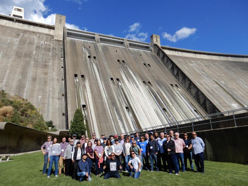
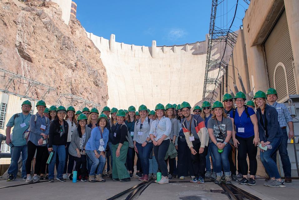
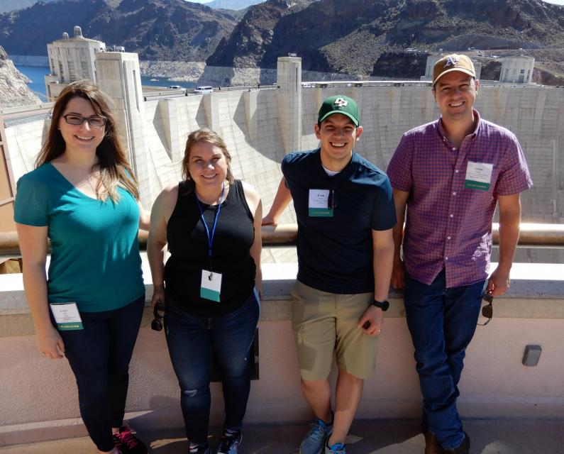
This tour explored the lower Colorado River firsthand where virtually every drop of the river is allocated, yet demand is growing from myriad sources — increasing population, declining habitat, drought and climate change.
The 1,450-mile river is a lifeline to some 40 million people in the Southwest across seven states, 30 tribal nations and Mexico. How the Lower Basin states – Arizona, California and Nevada – use and manage this water to meet agricultural, urban, environmental and industrial needs was the focus of this tour.
Hilton Garden Inn Las Vegas Strip South
7830 S Las Vegas Blvd
Las Vegas, NV 89123
It was exactly the sort of deluge
California groundwater agencies have been counting on to
replenish their overworked aquifers.
The start of 2023 brought a parade of torrential Pacific storms
to bone dry California. Snow piled up across the Sierra Nevada at
a near-record pace while runoff from the foothills gushed into
the Central Valley, swelling rivers over their banks and filling
seasonal creeks for the first time in half a decade.
Suddenly, water managers and farmers toiling in one of the
state’s most groundwater-depleted regions had an opportunity to
capture stormwater and bank it underground. Enterprising agencies
diverted water from rushing rivers and creeks into manmade
recharge basins or intentionally flooded orchards and farmland.
Others snagged temporary permits from the state to pull from
streams they ordinarily couldn’t touch.
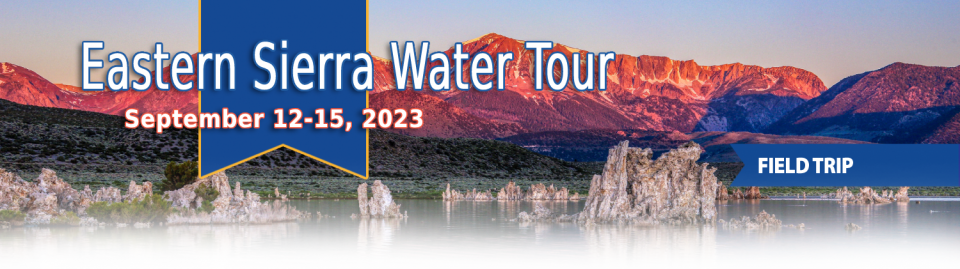
This special Foundation water tour journeyed along the Eastern Sierra from the Truckee River to Mono Lake, through the Owens Valley and into the Mojave Desert to explore a major source of water for Southern California, this year’s snowpack and challenges for towns, farms and the environment.
Growing up in the shadow of the
Rocky Mountains, Andrew Schwartz never missed an opportunity to
play in – or study – a Colorado snowstorm. During major
blizzards, he would traipse out into the icy wind and heavy
drifts of snow pretending to be a scientist researching in
Antarctica.
Decades later, still armed with an obsession for extreme weather,
Schwartz has landed in one of the snowiest places in the West,
leading a research lab whose mission is to give California water
managers instant information on the depth and quality of snow
draping the slopes of the Sierra Nevada.
This tour explored the Sacramento River and its tributaries through a scenic landscape while learning about the issues associated with a key source for the state’s water supply.
All together, the river and its tributaries supply 35 percent of California’s water and feed into two major projects: the State Water Project and the federal Central Valley Project.
Water Education Foundation
2151 River Plaza Drive, Suite 205
Sacramento, CA 95833
This tour explored the Sacramento River and its tributaries
through a scenic landscape while learning about the issues
associated with a key source for the state’s water supply.
All together, the river and its tributaries supply 35 percent of
California’s water and feed into two major projects: the State
Water Project and the federal Central Valley Project.
Water Education Foundation
2151 River Plaza Drive, Suite 205
Sacramento, CA 95833
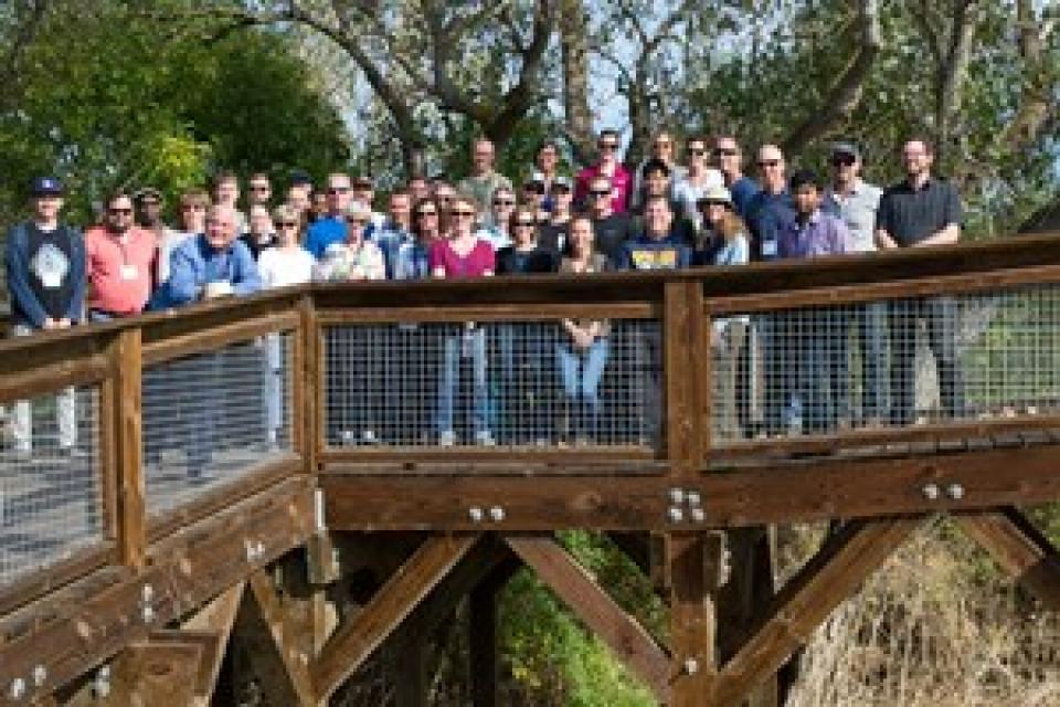
This tour traveled along the San Joaquin River to learn firsthand
about one of the nation’s largest and most expensive river
restoration projects.
The San Joaquin River was the focus of one of the most
contentious legal battles in California water history,
ending in a 2006 settlement between the federal government,
Friant Water Users Authority and a coalition of environmental
groups.
Hampton Inn & Suites Fresno
327 E Fir Ave
Fresno, CA 93720
This tour explored the lower Colorado River firsthand where virtually every drop of the river is allocated, yet demand is growing from myriad sources — increasing population, declining habitat, drought and climate change.
The 1,450-mile river is a lifeline to some 40 million people in the Southwest across seven states, 30 tribal nations and Mexico. How the Lower Basin states – Arizona, California and Nevada – use and manage this water to meet agricultural, urban, environmental and industrial needs was the focus of this tour.
Hyatt Place Las Vegas At Silverton Village
8380 Dean Martin Drive
Las Vegas, NV 89139
The lower Colorado River has virtually every drop allocated, yet demand is growing from myriad sources — increasing population, declining habitat, drought and climate change.
The 1,450-mile river is a lifeline to 40 million people in the Southwest across seven states, 30 tribal nations and Mexico. How the Lower Basin states – Arizona, California and Nevada – use and manage this water to meet agricultural, urban, environmental and industrial needs was the focus of this tour.
Hyatt Place Las Vegas At Silverton Village
8380 Dean Martin Drive
Las Vegas, NV 89139
Land and waterway managers labored
hard over the course of a century to control California’s unruly
rivers by building dams and levees to slow and contain their
water. Now, farmers, environmentalists and agencies are undoing
some of that work as part of an accelerating campaign to restore
the state’s major floodplains.
Biologists have designed a variety
of unique experiments in the past decade to demonstrate the
benefits that floodplains provide for small fish. Tracking
studies have used acoustic tags to show that chinook salmon
smolts with access to inundated fields are more likely than their
river-bound cohorts to reach the Pacific Ocean. This is because
the richness of floodplains offers a vital buffet of nourishment
on which young salmon can capitalize, supercharging their growth
and leading to bigger, stronger smolts.
This tour guided participants on a virtual exploration of the Sacramento River and its tributaries and learn about the issues associated with a key source for the state’s water supply.
All together, the river and its tributaries supply 35 percent of California’s water and feed into two major projects: the State Water Project and the federal Central Valley Project.
USACE Sacramento District has a proven track record of facing
challenges head-on. When 2020 brought with it the Novel
Coronavirus, the District responded quickly to address the
needs of a rapidly changing work environment…This year marked
the start of major construction on the [American River Common
Features] project, and the pandemic hit just as crews were
mobilizing, meaning both USACE and its contractors faced
unexpected public impacts.
This event explored the lower Colorado River where virtually every drop of the river is allocated, yet demand is growing from myriad sources — increasing population, declining habitat, drought and climate change.
The 1,450-mile river is a lifeline to 40 million people in the Southwest across seven states and Mexico. How the Lower Basin states – Arizona, California and Nevada – use and manage this water to meet agricultural, urban, environmental and industrial needs was the focus of this tour.
The islands of the western
Sacramento-San Joaquin Delta are sinking as the rich peat soil
that attracted generations of farmers dries out and decays. As
the peat decomposes, it releases tons of carbon dioxide – a
greenhouse gas – into the atmosphere. As the islands sink, the
levees that protect them are at increasing risk of failure, which
could imperil California’s vital water conveyance system.
An ambitious plan now in the works could halt the decay,
sequester the carbon and potentially reverse the sinking.
Many of California’s watersheds are
notoriously flashy – swerving from below-average flows to jarring
flood conditions in quick order. The state needs all the water it
can get from storms, but current flood management guidelines are
strict and unyielding, requiring reservoirs to dump water each
winter to make space for flood flows that may not come.
However, new tools and operating methods are emerging that could
lead the way to a redefined system that improves both water
supply and flood protection capabilities.
California is chock full of rivers and creeks, yet the state’s network of stream gauges has significant gaps that limit real-time tracking of how much water is flowing downstream, information that is vital for flood protection, forecasting water supplies and knowing what the future might bring.
That network of stream gauges got a big boost Sept. 30 with the signing of SB 19. Authored by Sen. Bill Dodd (D-Napa), the law requires the state to develop a stream gauge deployment plan, focusing on reactivating existing gauges that have been offline for lack of funding and other reasons. Nearly half of California’s stream gauges are dormant.
To survive the next drought and meet
the looming demands of the state’s groundwater sustainability
law, California is going to have to put more water back in the
ground. But as other Western states have found, recharging
overpumped aquifers is no easy task.
Successfully recharging aquifers could bring multiple benefits
for farms and wildlife and help restore the vital interconnection
between groundwater and rivers or streams. As local areas around
California draft their groundwater sustainability plans, though,
landowners in the hardest hit regions of the state know they will
have to reduce pumping to address the chronic overdraft in which
millions of acre-feet more are withdrawn than are naturally
recharged.
The Colorado River Basin’s 20 years
of drought and the dramatic decline in water levels at the
river’s key reservoirs have pressed water managers to adapt to
challenging conditions. But even more extreme — albeit rare —
droughts or floods that could overwhelm water managers may lie
ahead in the Basin as the effects of climate change take hold,
say a group of scientists. They argue that stakeholders who are
preparing to rewrite the operating rules of the river should plan
now for how to handle these so-called “black swan” events so
they’re not blindsided.
The majestic beauty of the Sierra
Nevada forest is awe-inspiring, but beneath the dazzling blue
sky, there is a problem: A century of fire suppression and
logging practices have left trees too close together. Millions of
trees have died, stricken by drought and beetle infestation.
Combined with a forest floor cluttered with dry brush and debris,
it’s a wildfire waiting to happen.
Fires devastate the Sierra watersheds upon which millions of
Californians depend — scorching the ground, unleashing a
battering ram of debris and turning hillsides into gelatinous,
stream-choking mudflows.
New to this year’s slate of water
tours, our Edge of
Drought Tour Aug. 27-29 will venture into the Santa
Barbara area to learn about the challenges of limited local
surface and groundwater supplies and the solutions being
implemented to address them.
Despite Santa Barbara County’s decision to lift a drought
emergency declaration after this winter’s storms replenished
local reservoirs, the region’s hydrologic recovery often has
lagged behind much of the rest of the state.
This tour explored the lower Colorado River where virtually every drop of the river is allocated, yet demand is growing from myriad sources — increasing population, declining habitat, drought and climate change.
The 1,450-mile river is a lifeline to 40 million people in the Southwest across seven states and Mexico. How the Lower Basin states – Arizona, California and Nevada – use and manage this water to meet agricultural, urban, environmental and industrial needs is the focus of this tour.
Silverton Hotel
3333 Blue Diamond Road
Las Vegas, NV 89139
Although Santa Monica may be the most aggressive Southern California water provider to wean itself from imported supplies, it is hardly the only one looking to remake its water portfolio.
In Los Angeles, a city of about 4 million people, efforts are underway to dramatically slash purchases of imported water while boosting the amount from recycling, stormwater capture, groundwater cleanup and conservation. Mayor Eric Garcetti in 2014 announced a plan to reduce the city’s purchase of imported water from Metropolitan Water District by one-half by 2025 and to provide one-half of the city’s supply from local sources by 2035. (The city considers its Eastern Sierra supplies as imported water.)
The whims of political fate decided
in 2018 that state bond money would not be forthcoming to help
repair the subsidence-damaged parts of Friant-Kern Canal, the
152-mile conduit that conveys water from the San Joaquin River to
farms that fuel a multibillion-dollar agricultural economy along
the east side of the fertile San Joaquin Valley.
Just because El Niño may be lurking
off in the tropical Pacific, does that really offer much of a
clue about what kind of rainy season California can expect in
Water Year 2019?
Will a river of storms pound the state, swelling streams and
packing the mountains with deep layers of heavy snow much like
the exceptionally wet 2017 Water Year (Oct. 1, 2016 to Sept. 30,
2017)? Or will this winter sputter along like last winter,
leaving California with a second dry year and the possibility of
another potential drought? What can reliably be said about the
prospects for Water Year 2019?
At Water Year
2019: Feast or Famine?, a one-day event on Dec. 5 in Irvine,
water managers and anyone else interested in this topic will
learn about what is and isn’t known about forecasting
California’s winter precipitation weeks to months ahead, the
skill of present forecasts and ongoing research to develop
predictive ability.
This tour explored the Sacramento River and its tributaries
through a scenic landscape as participants learned about the
issues associated with a key source for the state’s water supply.
All together, the river and its tributaries supply 35 percent of
California’s water and feed into two major projects: the State
Water Project and the federal Central Valley Project. Tour
participants got an on-site update of Oroville Dam spillway
repairs.
There’s going to be a new governor
in California next year – and a host of challenges both old and
new involving the state’s most vital natural resource, water.
So what should be the next governor’s water priorities?
That was one of the questions put to more than 150 participants
during a wrap-up session at the end of the Water Education
Foundation’s Sept. 20 Water Summit in Sacramento.
The Colorado River Basin is more
than likely headed to unprecedented shortage in 2020 that could
force supply cuts to some states, but work is “furiously”
underway to reduce the risk and avert a crisis, Bureau of
Reclamation Commissioner Brenda Burman told an audience of
California water industry people.
During a keynote address at the Water Education Foundation’s
Sept. 20 Water Summit in Sacramento, Burman said there is
opportunity for Colorado River Basin states to control their
destiny, but acknowledged that in water, there are no guarantees
that agreement can be reached.
Farmers in the Central Valley are broiling about California’s plan to increase flows in the Sacramento and San Joaquin river systems to help struggling salmon runs avoid extinction. But in one corner of the fertile breadbasket, River Garden Farms is taking part in some extraordinary efforts to provide the embattled fish with refuge from predators and enough food to eat.
And while there is no direct benefit to one farm’s voluntary actions, the belief is what’s good for the fish is good for the farmers.
We explored the lower Colorado River where virtually every drop
of the river is allocated, yet demand is growing from myriad
sources — increasing population, declining habitat, drought and
climate change.
The 1,450-mile river is a lifeline to 40 million people in
the Southwest across seven states and Mexico. How the Lower Basin
states – Arizona, California and Nevada – use and manage this
water to meet agricultural, urban, environmental and industrial
needs was the focus of this tour.
Hampton Inn Tropicana
4975 Dean Martin Drive, Las Vegas, NV 89118
California voters may experience a sense of déjà vu this year when they are asked twice in the same year to consider water bonds — one in June, the other headed to the November ballot.
Both tackle a variety of water issues, from helping disadvantaged communities get clean drinking water to making flood management improvements. But they avoid more controversial proposals, such as new surface storage, and they propose to do some very different things to appeal to different constituencies.
Every day, people flock to Daniel
Swain’s social media platforms to find out the latest news and
insight about California’s notoriously unpredictable weather.
Swain, a climate scientist at the Institute of the
Environment and Sustainability at UCLA, famously coined the
term “Ridiculously Resilient Ridge” in December 2013 to describe
the large, formidable high-pressure mass that was parked over the
West Coast during winter and diverted storms away from
California, intensifying the drought.
Swain’s research focuses on atmospheric processes that cause
droughts and floods, along with the changing character of extreme
weather events in a warming world. A lifelong Californian and
alumnus of University of California, Davis, and Stanford
University, Swain is best known for the widely read Weather West blog, which provides
unique perspectives on weather and climate in California and the
western United States. In a recent interview with Western
Water, he talked about the Ridiculously Resilient Ridge, its
potential long-term impact on California weather, and what may
lie ahead for the state’s water supply.
Atmospheric rivers are relatively
narrow bands of moisture that ferry precipitation across the
Pacific Ocean to the West Coast and are key to California’s
water
supply.
This three-day, two-night tour explored the lower Colorado River
where virtually every drop of the river is allocated, yet demand
is growing from myriad sources — increasing population,
declining habitat, drought and climate change.
The 1,450-mile river is a lifeline to 40 million people in
the Southwest across seven states and Mexico. How the Lower Basin
states – Arizona, California and Nevada – use and manage this
water to meet agricultural, urban, environmental and industrial
needs is the focus of this tour.
Best Western McCarran Inn
4970 Paradise Road
Las Vegas, NV 89119
This tour explored the Sacramento River and its tributaries
through a scenic landscape as participants learned about the
issues associated with a key source for the state’s water supply.
All together, the river and its tributaries supply 35 percent of
California’s water and feed into two major projects: the State
Water Project and the federal Central Valley Project. Tour
participants got an on-site update of repair efforts on the
Oroville Dam spillway.
Participants of this tour snaked along the San Joaquin River to
learn firsthand about one of the nation’s largest and most
expensive river restoration projects.
The San Joaquin River was the focus of one of the most
contentious legal battles in California water history,
ending in a 2006 settlement between the federal government,
Friant Water Users Authority and a coalition of environmental
groups.
In a state with such topsy-turvy weather as California, the
ability of forecasters to peer into the vast expanse of the
Pacific Ocean and accurately predict the arrival of storms is a
must to improve water supply reliability and flood management
planning.
The problem, according to Jeanine Jones, interstate resources
manager with the state Department of Water Resources, is
that “we have been managing with 20th century
technology with respect to our ability to do weather
forecasting.”
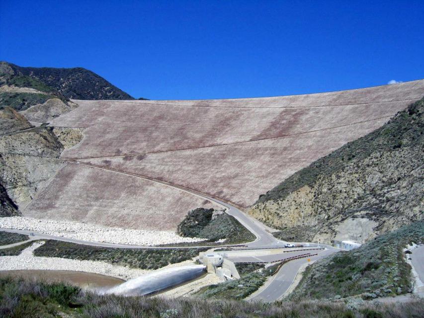
Work crews repairing Oroville Dam’s damaged emergency spillway
are dumping 1,200 tons of rock each hour and using shotcrete to
stabilize the hillside slope, an official with the Department of
Water Resources told the California Water Commission today.
The pace of work is “round the clock,” said Kasey Schimke,
assistant director of DWR’s legislative affairs office.
ARkStorm stands for an atmospheric
river (“AR”) that carries precipitation levels expected to occur
once every 1,000 years (“k”). The concept was presented in a 2011
report by the U.S. Geological Survey (USGS) intended to elevate
the visibility of the very real threats to human life, property
and ecosystems posed by extreme storms on the West Coast.
A hydrograph illustrates a type of activity of water during a
specific time frame. Salinity and acidity are sometimes measured,
but the most common types
are stage and discharge hydrographs. These graphs show how
surface water flow responds to fluxes in precipitation.
Prado Dam – built in 1941 in
response to the Santa Ana
River’s flood-prone past – separates the river into its
upper and lower watersheds. After the devastation of the
deadly Los
Angeles Flood of 1938 that impacted much of Southern
California, it became evident that flood protection was woefully
inadequate, prompting the U.S. Army Corps of Engineers to
construct Prado Dam.
Contrary to popular belief, “100-Year Flood” does not refer to a
flood that happens every century. Rather, the term describes the
statistical chance of a flood of a certain magnitude (or greater)
taking place once in 100 years. It is also accurate to say a
so-called “100-Year Flood” has a 1 percent chance of occurring in
a given year, and those living in a 100-year floodplain have,
each year, a 1 percent chance of being flooded.
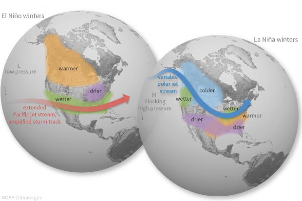
California’s seasonal weather is
influenced by El Niño and La Niña – temporary climatic conditions
that, depending on their severity, make the weather wetter or
drier than normal.
El Niño and La Niña episodes typically last 9 to 12 months,
but some may last for years. While their frequency can be quite
irregular, El Niño and La Niña events occur on average every two
to seven years. Typically, El Niño occurs more frequently than La
Niña, according to the National Oceanic and Atmospheric
Administration (NOAA).
This 30-minute documentary, produced in 2011, explores the past,
present and future of flood management in California’s Central
Valley. It features stories from residents who have experienced
the devastating effects of a California flood firsthand.
Interviews with long-time Central Valley water experts from
California Department of Water Resources (FloodSAFE), U.S. Army
Corps of Engineers, Bureau of Reclamation, Central Valley Flood
Management Program and environmental groups are featured as they
discuss current efforts to improve the state’s 150-year old flood
protection system and develop a sustainable, integrated, holistic
flood management plan for the Central Valley.
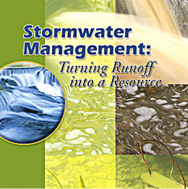
20-minute DVD that explains the problem with polluted stormwater,
and steps that can be taken to help prevent such pollution and
turn what is often viewed as a “nuisance” into a water resource
through various activities.
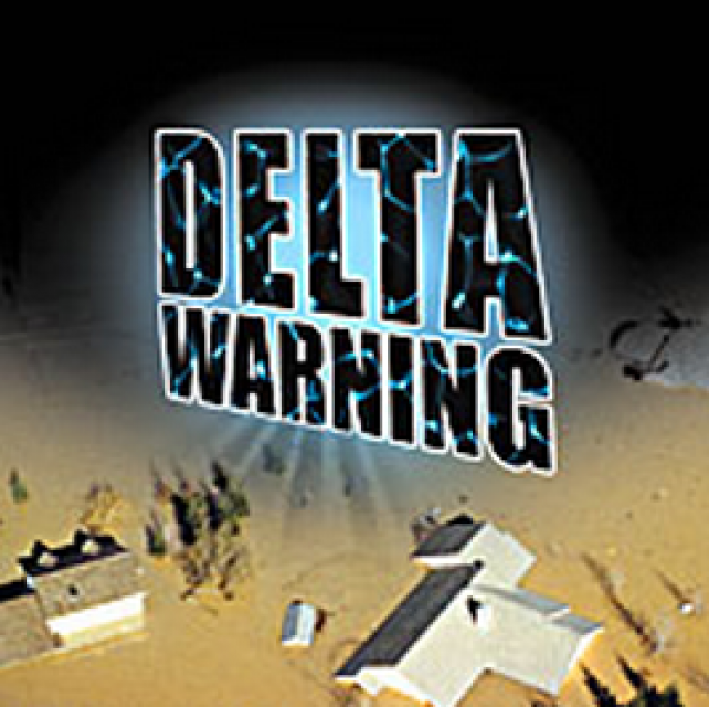
15-minute DVD that graphically portrays the potential disaster
should a major earthquake hit the Sacramento-San Joaquin Delta.
“Delta Warning” depicts what would happen in the event of an
earthquake registering 6.5 on the Richter scale: 30 levee breaks,
16 flooded islands and a 300 billion gallon intrusion of salt
water from the Bay – the “big gulp” – which would shut down the
State Water Project and Central Valley Project pumping plants.
Water truly has shaped California into the great state it is
today. And if it is water that made California great, it’s the
fight over – and with – water that also makes it so critically
important. In efforts to remap California’s circulatory system,
there have been some critical events that had a profound impact
on California’s water history. These turning points not only
forced a re-evaluation of water, but continue to impact the lives
of every Californian. This 2005 PBS documentary offers a
historical and current look at the major water issues that shaped
the state we know today. Includes a 12-page viewer’s guide with
background information, historic timeline and a teacher’s lesson.
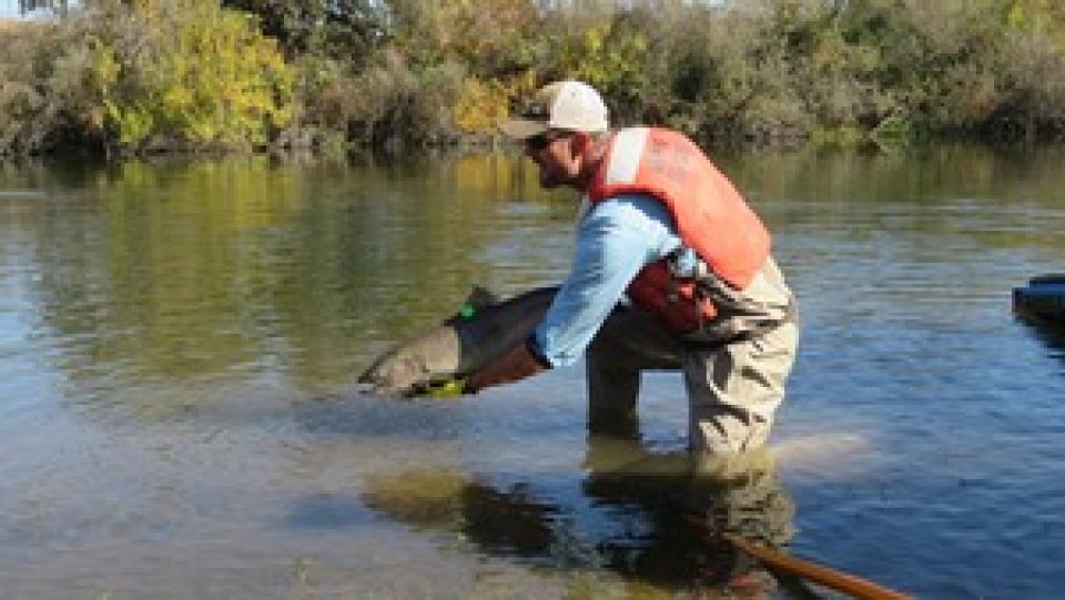
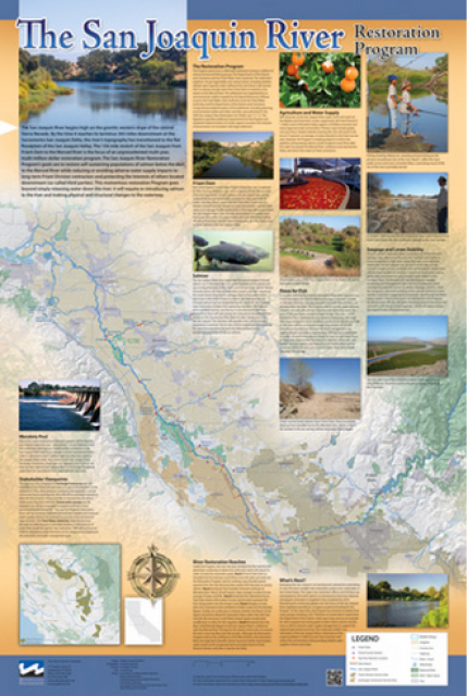
This beautiful 24×36 inch poster, suitable for framing, features
a map of the San Joaquin River. The map text focuses on the San
Joaquin River Restoration Program, which aims to restore flows
and populations of Chinook salmon to the river below Friant Dam
to its confluence with the Merced River. The text discusses the
history of the program, its goals and ongoing challenges with
implementation.
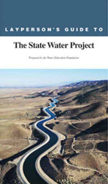
The 24-page Layperson’s Guide to the State Water Project provides
an overview of the California-funded and constructed State Water
Project.
The State Water Project is best known for the 444-mile-long
aqueduct that provides water from the Delta to San Joaquin Valley
agriculture and southern California cities. The guide contains
information about the project’s history and facilities.
The 24-page Layperson’s Guide to Integrated Regional Water
Management (IRWM) is an in-depth, easy-to-understand publication
that provides background information on the principles of IRWM,
its funding history and how it differs from the traditional water
management approach.
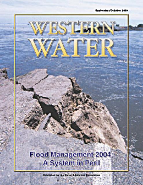
The 24-page Layperson’s Guide to Flood Management explains the
physical flood control system, including levees; discusses
previous flood events (including the 1997 flooding); explores
issues of floodplain management and development; provides an
overview of flood forecasting; and outlines ongoing flood control
projects.
The 24-page Layperson’s Guide to California Water provides an
excellent overview of the history of water development and use in
California. It includes sections on flood management; the state,
federal and Colorado River delivery systems; Delta issues; water
rights; environmental issues; water quality; and options for
stretching the water supply such as water marketing and
conjunctive use. New in this 10th edition of the guide is a
section on the human need for water.
The 24-page Layperson’s Guide to the Central Valley Project
explores the history and development of the federal Central
Valley Project (CVP), California’s largest surface water delivery
system. In addition to the project’s history, the guide describes
the various CVP facilities, CVP operations, the benefits the CVP
brought to the state and the CVP Improvement Act (CVPIA).
The 24-page Layperson’s Guide to the Delta explores the competing
uses and demands on California’s Sacramento-San Joaquin Delta.
Included in the guide are sections on the history of the Delta,
its role in the state’s water system, and its many complex issues
with sections on water quality, levees, salinity and agricultural
drainage, fish and wildlife, and water distribution.
A new look for our most popular product! And it’s the perfect
gift for the water wonk in your life.
Our 24×36 inch California Water Map is widely known for being the
definitive poster that shows the integral role water plays in the
state. On this updated version, it is easier to see California’s
natural waterways and man-made reservoirs and aqueducts
– including federally, state and locally funded
projects – the wild and scenic rivers system, and
natural lakes. The map features beautiful photos of
California’s natural environment, rivers, water projects,
wildlife, and urban and agricultural uses and the
text focuses on key issues: water supply, water use, water
projects, the Delta, wild and scenic rivers and the Colorado
River.
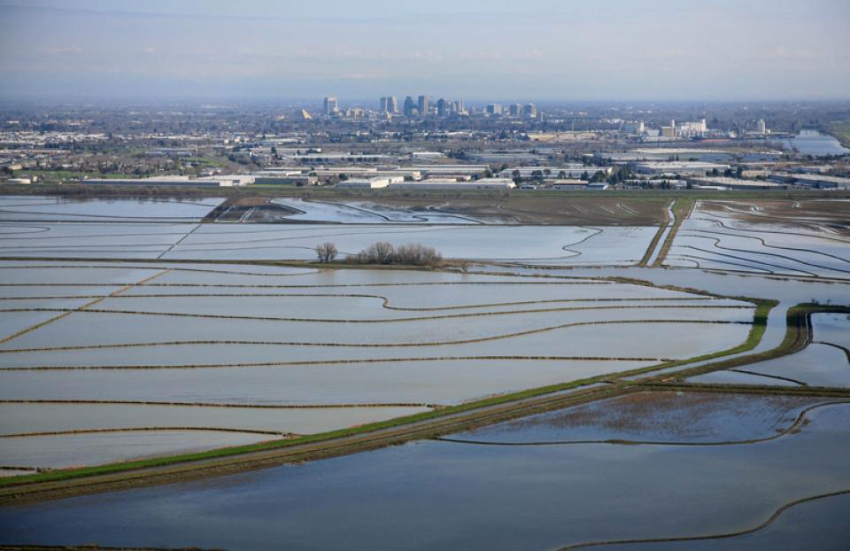
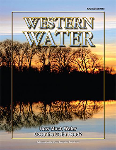
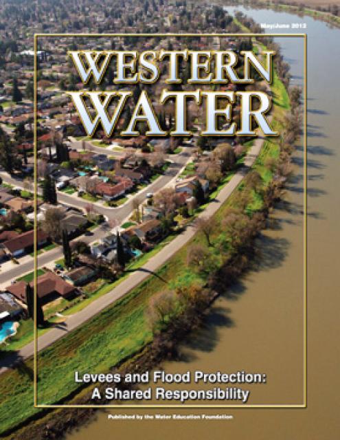
With the dual threats of obsolete levees and anticipated rising sea levels,
floodplains—low
areas adjacent to waterways that flood during wet years—are
increasingly at the forefront of many public policy and water
issues in California.
Adding to the challenges, many floodplains have been heavily
developed and are home to major cities such as Sacramento. Large
parts of California’s valleys are historic floodplains as well.
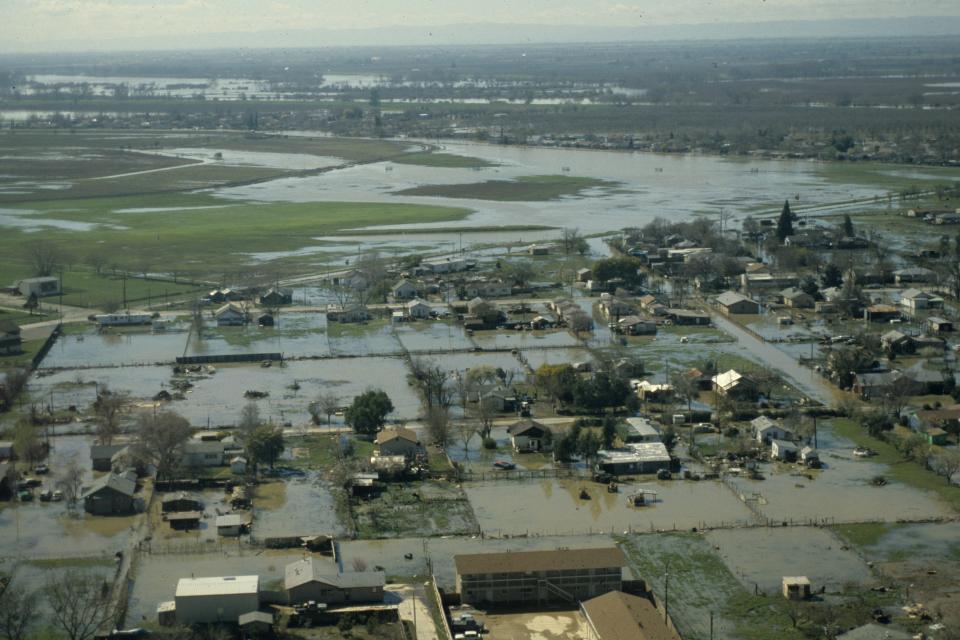
When people think of natural
disasters in California, they typically think about earthquakes.
Yet the natural disaster that residents are most likely to face
involves flooding, not fault lines. In fact, all 58 counties in
the state have declared a state of emergency from flooding at
least three times since 1950. And the state’s capital,
Sacramento, is considered one of the nation’s most flood-prone
cities. Floods also affect every Californian because flood
management projects and damages are paid with public funds.
Flood forecasting allows flood control managers to predict,
with a high degree of accuracy, when local flooding is
likely to take place.
Forecasts typically use storm runoff data, reservoir levels and
releases to predict the rise in river levels.
In Northern California the National Weather Service, in
cooperation with the state’s California-Nevada River Forecast
Center in Sacramento, forecasts flooding.
Yolo Bypass occupies a historic floodplain between Davis and
Sacramento, California. The Yolo Bypass is part of a larger
engineered system developed on the Sacramento River to
provide bypass flood areas, which act as catch basins to
deter flooding in communities such as Sacramento and West
Sacramento.
Liability for levee failure in California took a new turn after a
court ruling found the state liable for hundreds of millions of
dollars from the 1986 Linda Levee collapse in Yuba County. The
levee failure killed two people and destroyed or damaged about
3,000 homes.
The collapse also had long-term legal ramifications.
The Paterno Decision
California’s Supreme Court found that, “when a public entity
operates a flood management system built by someone else, it
accepts liability as if it had planned and built the system
itself.”
Dams have allowed Californians and others across the West to
harness and control water dating back to pre-European settlement
days when Native Americans had erected simple dams for catching
salmon.
This printed issue of Western Water This issue of Western Water
looks at climate change through the lens of some of the latest
scientific research and responses from experts regarding
mitigation and adaptation.
This issue of Western Water looks at the BDCP and the
Coalition to Support Delta Projects, issues that are aimed at
improving the health and safety of the Delta while solidifying
California’s long-term water supply reliability.
This printed issue of Western Water features a
roundtable discussion with Anthony Saracino, a water resources
consultant; Martha Davis, executive manager of policy development
with the Inland Empire Utilities Agency and senior policy advisor
to the Delta Stewardship Council; Stuart Leavenworth, editorial
page editor of The Sacramento Bee and Ellen Hanak, co-director of
research and senior fellow at the Public Policy Institute of
California.
This printed issue of Western Water examines the issues
associated with the State Water Board’s proposed revision of the
water quality Bay-Delta Plan, most notably the question of
whether additional flows are needed for the system, and how they
might be provided.
This printed issue of Western Water discusses several
flood-related issues, including the proposed Central Valley Flood
Protection Plan, the FEMA remapping process and the dispute
between the state and the Corps regarding the levee vegetation
policy.
Levees are one of those pieces of engineering that are never
really appreciated until they fail. California would not exist as
it does today were it not for the extensive system of levees,
weirs and flood bypasses that have been built through the years.
This printed copy of Western Water examines climate change –
what’s known about it, the remaining uncertainty and what steps
water agencies are talking to prepare for its impact. Much of the
information comes from the October 2007 California Climate Change
and Water Adaptation Summit sponsored by the Water Education
Foundation and DWR and the November 2007 California Water Policy
Conference sponsored by Public Officials for Water and
Environmental Reform.
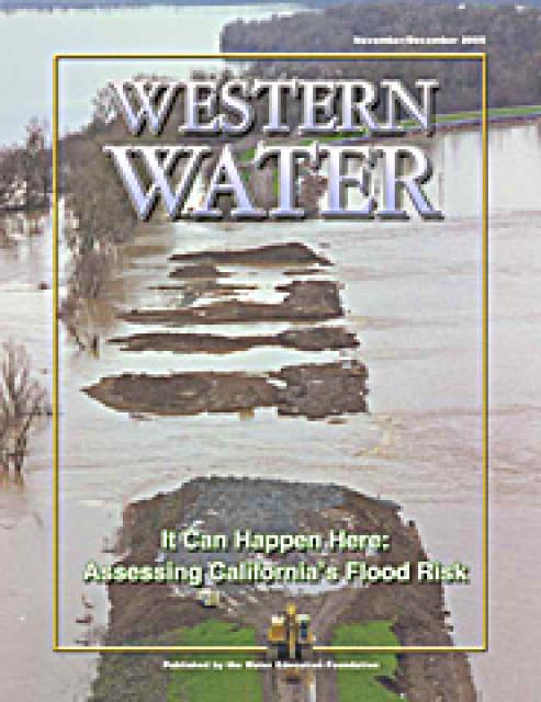
This issue of Western Water examines the extent to
which California faces a disaster equal to or greater than the
New Orleans floods and the steps being taken to recognize and
address the shortcomings of the flood control system in the
Central Valley and the Delta, which is of critical importance
because of its role in providing water to 22 million people.
Complicating matters are the state’s skyrocketing pace of growth
coupled with an inherently difficult process of obtaining secure,
long-term funds for levee repairs and continued maintenance.
Is the devastating flooding that occurred in the wake of
Hurricane Katrina in the Gulf Coast an ominous warning to
California? That’s the question policymakers are facing as they
consider how to best protect lives, property and the integrity of
the state’s water supply from the forces of raging floodwaters.
This issue of Western Water analyzes northern California’s
extensive flood control system – it’ history, current concerns,
the Paterno decision and how experts are re-thinking the concept
of flood management.
Some time in the next month or two, slight, temporal changes in
the upper atmosphere will augur the beginning of the rainy
portion of California’s Mediterranean climate. The high pressure
and sunny days should gradually give way to rain and snow,
replenishing the vast reservoir that is the state’s precious
water supply.
For many of us in northern California, some of the hope and
optimism that fills each New Year’s eve was shattered on New
Year’s Day 1997 when rain from a series of huge tropical storms
began dumping what would eventually be a total of 25 inches of
rain over the region in eight days. People were riveted to their
televisions as the disaster, which took 9 lives, unfolded.


")

")
")


")

")
")
 and temperature. This gauge near downtown Sacramento measures water depth. (Source: California Department of Water Resources)")
")
")
")

")
")

")
")
")


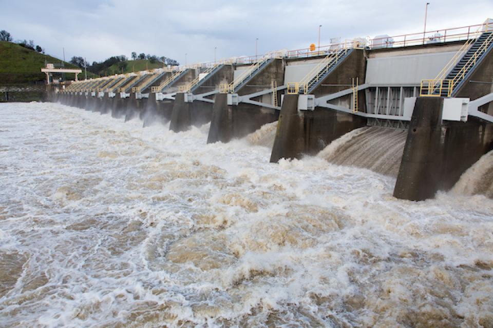
")


 overtops the Tisdale Weir in Sutter County south of Yuba City on Feb. 6, 2024. Weirs allow flood flows above the downstream channel capacity to escape into a bypass channel or basin. Credit: California Department of Water Resources")